You are here: Home > Network List > UU - University of Utah Regional Network Stations List
> Station FORU South Mineral Mountains, UT, USA > Earthquake Result Viewer
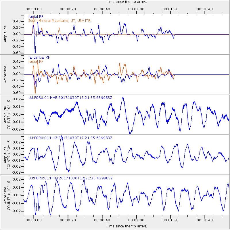
FORU South Mineral Mountains, UT, USA - Earthquake Result Viewer
*The percent match for this event was below the threshold and hence no stack was calculated.
| Earthquake location: |
Central Peru |
| Earthquake latitude/longitude: |
-10.7/-74.7 |
| Earthquake time(UTC): |
2017/10/30 (303) 17:12:06 GMT |
| Earthquake Depth: |
101 km |
| Earthquake Magnitude: |
5.7 mb |
| Earthquake Catalog/Contributor: |
NEIC PDE/us |
|
| Network: |
UU University of Utah Regional Network |
| Station: |
FORU South Mineral Mountains, UT, USA |
| Lat/Lon: |
38.46 N/112.86 W |
| Elevation: |
1840 m |
|
| Distance: |
60.5 deg |
| Az: |
326.134 deg |
| Baz: |
135.77 deg |
| Ray Param: |
$rayparam |
*The percent match for this event was below the threshold and hence was not used in the summary stack. |
|
| Radial Match: |
67.43719 % |
| Radial Bump: |
400 |
| Transverse Match: |
75.588196 % |
| Transverse Bump: |
363 |
| SOD ConfigId: |
2429771 |
| Insert Time: |
2017-11-13 17:16:46.161 +0000 |
| GWidth: |
2.5 |
| Max Bumps: |
400 |
| Tol: |
0.001 |
|
Signal To Noise
| Channel | StoN | STA | LTA |
| UU:FORU:01:HHZ:20171030T17:21:35.639983Z | 0.92705315 | 7.603281E-9 | 8.2015585E-9 |
| UU:FORU:01:HHN:20171030T17:21:35.639983Z | 3.3684251 | 1.2857751E-8 | 3.8171404E-9 |
| UU:FORU:01:HHE:20171030T17:21:35.639983Z | 1.1737822 | 6.643739E-9 | 5.660112E-9 |
| Arrivals |
| Ps | |
| PpPs | |
| PsPs/PpSs | |


