You are here: Home > Network List > CI - Caltech Regional Seismic Network Stations List
> Station SMM Simmler, CA, USA > Earthquake Result Viewer
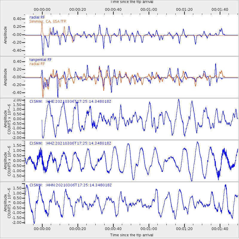
SMM Simmler, CA, USA - Earthquake Result Viewer
*The percent match for this event was below the threshold and hence no stack was calculated.
| Earthquake location: |
Kermadec Islands Region |
| Earthquake latitude/longitude: |
-30.2/-176.9 |
| Earthquake time(UTC): |
2021/03/06 (065) 17:13:13 GMT |
| Earthquake Depth: |
10 km |
| Earthquake Magnitude: |
5.6 Mww |
| Earthquake Catalog/Contributor: |
NEIC PDE/us |
|
| Network: |
CI Caltech Regional Seismic Network |
| Station: |
SMM Simmler, CA, USA |
| Lat/Lon: |
35.31 N/120.00 W |
| Elevation: |
599 m |
|
| Distance: |
84.3 deg |
| Az: |
43.517 deg |
| Baz: |
226.795 deg |
| Ray Param: |
$rayparam |
*The percent match for this event was below the threshold and hence was not used in the summary stack. |
|
| Radial Match: |
62.625168 % |
| Radial Bump: |
400 |
| Transverse Match: |
63.552227 % |
| Transverse Bump: |
400 |
| SOD ConfigId: |
23341671 |
| Insert Time: |
2021-03-20 18:19:38.970 +0000 |
| GWidth: |
2.5 |
| Max Bumps: |
400 |
| Tol: |
0.001 |
|
Signal To Noise
| Channel | StoN | STA | LTA |
| CI:SMM: :HHZ:20210306T17:25:14.348018Z | 0.97569907 | 6.7125035E-7 | 6.8796857E-7 |
| CI:SMM: :HHN:20210306T17:25:14.348018Z | 0.74385816 | 7.4208856E-7 | 9.976211E-7 |
| CI:SMM: :HHE:20210306T17:25:14.348018Z | 0.4640879 | 5.254171E-7 | 1.1321498E-6 |
| Arrivals |
| Ps | |
| PpPs | |
| PsPs/PpSs | |


