You are here: Home > Network List > TA - USArray Transportable Network (new EarthScope stations) Stations List
> Station POKR Poker Plat Research Range, AK, USA > Earthquake Result Viewer
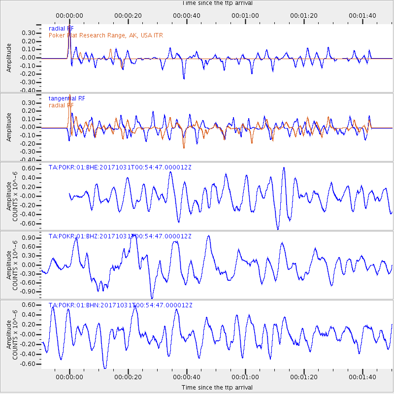
POKR Poker Plat Research Range, AK, USA - Earthquake Result Viewer
*The percent match for this event was below the threshold and hence no stack was calculated.
| Earthquake location: |
Southeast Of Loyalty Islands |
| Earthquake latitude/longitude: |
-21.7/169.2 |
| Earthquake time(UTC): |
2017/10/31 (304) 00:42:06 GMT |
| Earthquake Depth: |
9.1 km |
| Earthquake Magnitude: |
6.8 Mww |
| Earthquake Catalog/Contributor: |
NEIC PDE/us |
|
| Network: |
TA USArray Transportable Network (new EarthScope stations) |
| Station: |
POKR Poker Plat Research Range, AK, USA |
| Lat/Lon: |
65.12 N/147.43 W |
| Elevation: |
501 m |
|
| Distance: |
92.7 deg |
| Az: |
16.905 deg |
| Baz: |
219.741 deg |
| Ray Param: |
$rayparam |
*The percent match for this event was below the threshold and hence was not used in the summary stack. |
|
| Radial Match: |
50.140118 % |
| Radial Bump: |
400 |
| Transverse Match: |
56.337257 % |
| Transverse Bump: |
400 |
| SOD ConfigId: |
2429771 |
| Insert Time: |
2017-11-14 00:43:35.988 +0000 |
| GWidth: |
2.5 |
| Max Bumps: |
400 |
| Tol: |
0.001 |
|
Signal To Noise
| Channel | StoN | STA | LTA |
| TA:POKR:01:BHZ:20171031T00:54:47.000012Z | 2.7277565 | 4.6531943E-7 | 1.7058687E-7 |
| TA:POKR:01:BHN:20171031T00:54:47.000012Z | 1.0085264 | 2.4441957E-7 | 2.4235317E-7 |
| TA:POKR:01:BHE:20171031T00:54:47.000012Z | 1.4337323 | 2.3004242E-7 | 1.6045006E-7 |
| Arrivals |
| Ps | |
| PpPs | |
| PsPs/PpSs | |


