You are here: Home > Network List > CI - Caltech Regional Seismic Network Stations List
> Station LRL Laurel Mtn Radio Fac, Ridgecrest, CA, USA > Earthquake Result Viewer
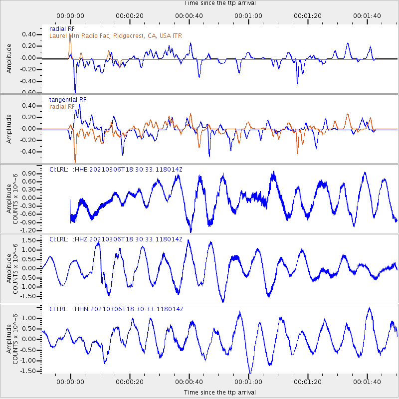
LRL Laurel Mtn Radio Fac, Ridgecrest, CA, USA - Earthquake Result Viewer
*The percent match for this event was below the threshold and hence no stack was calculated.
| Earthquake location: |
Mariana Islands Region |
| Earthquake latitude/longitude: |
21.1/144.5 |
| Earthquake time(UTC): |
2021/03/06 (065) 18:18:34 GMT |
| Earthquake Depth: |
14 km |
| Earthquake Magnitude: |
5.5 mww |
| Earthquake Catalog/Contributor: |
NEIC PDE/us |
|
| Network: |
CI Caltech Regional Seismic Network |
| Station: |
LRL Laurel Mtn Radio Fac, Ridgecrest, CA, USA |
| Lat/Lon: |
35.48 N/117.68 W |
| Elevation: |
1340 m |
|
| Distance: |
84.1 deg |
| Az: |
54.373 deg |
| Baz: |
291.577 deg |
| Ray Param: |
$rayparam |
*The percent match for this event was below the threshold and hence was not used in the summary stack. |
|
| Radial Match: |
68.09477 % |
| Radial Bump: |
400 |
| Transverse Match: |
67.08222 % |
| Transverse Bump: |
400 |
| SOD ConfigId: |
23341671 |
| Insert Time: |
2021-03-20 19:24:58.857 +0000 |
| GWidth: |
2.5 |
| Max Bumps: |
400 |
| Tol: |
0.001 |
|
Signal To Noise
| Channel | StoN | STA | LTA |
| CI:LRL: :HHZ:20210306T18:30:33.118014Z | 0.82931983 | 3.1981347E-7 | 3.8563346E-7 |
| CI:LRL: :HHN:20210306T18:30:33.118014Z | 0.6561416 | 2.0234148E-7 | 3.0838083E-7 |
| CI:LRL: :HHE:20210306T18:30:33.118014Z | 1.7660187 | 5.4738814E-7 | 3.09956E-7 |
| Arrivals |
| Ps | |
| PpPs | |
| PsPs/PpSs | |


