You are here: Home > Network List > US - United States National Seismic Network Stations List
> Station NEW Newport, Washington, USA > Earthquake Result Viewer
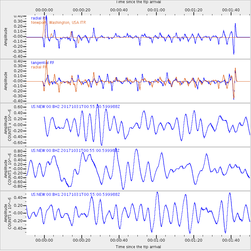
NEW Newport, Washington, USA - Earthquake Result Viewer
*The percent match for this event was below the threshold and hence no stack was calculated.
| Earthquake location: |
Southeast Of Loyalty Islands |
| Earthquake latitude/longitude: |
-21.7/169.2 |
| Earthquake time(UTC): |
2017/10/31 (304) 00:42:06 GMT |
| Earthquake Depth: |
9.1 km |
| Earthquake Magnitude: |
6.8 Mww |
| Earthquake Catalog/Contributor: |
NEIC PDE/us |
|
| Network: |
US United States National Seismic Network |
| Station: |
NEW Newport, Washington, USA |
| Lat/Lon: |
48.26 N/117.12 W |
| Elevation: |
760 m |
|
| Distance: |
95.6 deg |
| Az: |
40.118 deg |
| Baz: |
243.771 deg |
| Ray Param: |
$rayparam |
*The percent match for this event was below the threshold and hence was not used in the summary stack. |
|
| Radial Match: |
60.63444 % |
| Radial Bump: |
400 |
| Transverse Match: |
53.382828 % |
| Transverse Bump: |
334 |
| SOD ConfigId: |
2429771 |
| Insert Time: |
2017-11-14 00:43:48.380 +0000 |
| GWidth: |
2.5 |
| Max Bumps: |
400 |
| Tol: |
0.001 |
|
Signal To Noise
| Channel | StoN | STA | LTA |
| US:NEW:00:BHZ:20171031T00:55:00.599988Z | 1.4705373 | 3.2373882E-7 | 2.2015001E-7 |
| US:NEW:00:BH1:20171031T00:55:00.599988Z | 0.8644611 | 1.6510208E-7 | 1.9098844E-7 |
| US:NEW:00:BH2:20171031T00:55:00.599988Z | 1.8260183 | 4.0777817E-7 | 2.2331548E-7 |
| Arrivals |
| Ps | |
| PpPs | |
| PsPs/PpSs | |


