You are here: Home > Network List > US - United States National Seismic Network Stations List
> Station WUAZ Wupatki, Arizona, USA > Earthquake Result Viewer
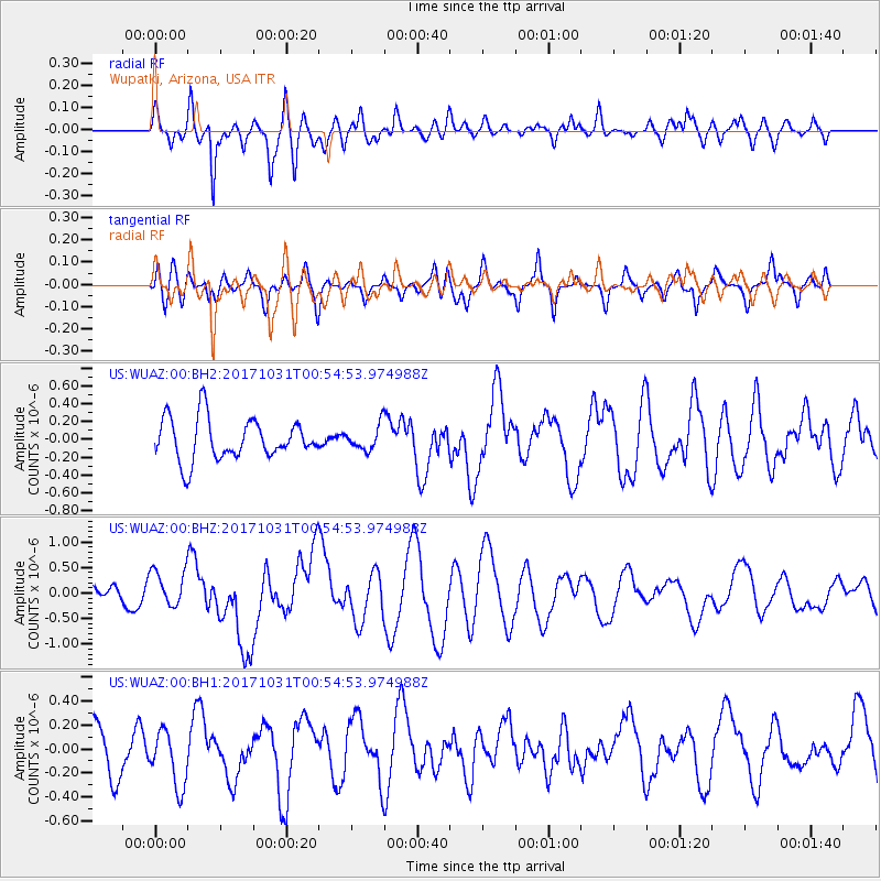
WUAZ Wupatki, Arizona, USA - Earthquake Result Viewer
*The percent match for this event was below the threshold and hence no stack was calculated.
| Earthquake location: |
Southeast Of Loyalty Islands |
| Earthquake latitude/longitude: |
-21.7/169.2 |
| Earthquake time(UTC): |
2017/10/31 (304) 00:42:06 GMT |
| Earthquake Depth: |
9.1 km |
| Earthquake Magnitude: |
6.8 Mww |
| Earthquake Catalog/Contributor: |
NEIC PDE/us |
|
| Network: |
US United States National Seismic Network |
| Station: |
WUAZ Wupatki, Arizona, USA |
| Lat/Lon: |
35.52 N/111.37 W |
| Elevation: |
1592 m |
|
| Distance: |
94.2 deg |
| Az: |
53.518 deg |
| Baz: |
246.466 deg |
| Ray Param: |
$rayparam |
*The percent match for this event was below the threshold and hence was not used in the summary stack. |
|
| Radial Match: |
57.711147 % |
| Radial Bump: |
400 |
| Transverse Match: |
62.63419 % |
| Transverse Bump: |
400 |
| SOD ConfigId: |
2429771 |
| Insert Time: |
2017-11-14 00:43:52.361 +0000 |
| GWidth: |
2.5 |
| Max Bumps: |
400 |
| Tol: |
0.001 |
|
Signal To Noise
| Channel | StoN | STA | LTA |
| US:WUAZ:00:BHZ:20171031T00:54:53.974988Z | 2.42 | 3.6048183E-7 | 1.4895944E-7 |
| US:WUAZ:00:BH1:20171031T00:54:53.974988Z | 1.163438 | 2.3343291E-7 | 2.0064063E-7 |
| US:WUAZ:00:BH2:20171031T00:54:53.974988Z | 0.5929304 | 1.3657608E-7 | 2.3034083E-7 |
| Arrivals |
| Ps | |
| PpPs | |
| PsPs/PpSs | |


