You are here: Home > Network List > TA - USArray Transportable Network (new EarthScope stations) Stations List
> Station E20K Nigu River, AK, USA > Earthquake Result Viewer
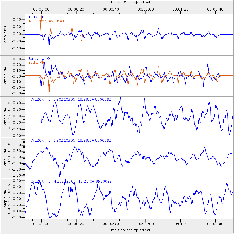
E20K Nigu River, AK, USA - Earthquake Result Viewer
*The percent match for this event was below the threshold and hence no stack was calculated.
| Earthquake location: |
Mariana Islands Region |
| Earthquake latitude/longitude: |
21.1/144.5 |
| Earthquake time(UTC): |
2021/03/06 (065) 18:18:34 GMT |
| Earthquake Depth: |
14 km |
| Earthquake Magnitude: |
5.5 mww |
| Earthquake Catalog/Contributor: |
NEIC PDE/us |
|
| Network: |
TA USArray Transportable Network (new EarthScope stations) |
| Station: |
E20K Nigu River, AK, USA |
| Lat/Lon: |
68.26 N/156.19 W |
| Elevation: |
866 m |
|
| Distance: |
59.4 deg |
| Az: |
21.87 deg |
| Baz: |
248.99 deg |
| Ray Param: |
$rayparam |
*The percent match for this event was below the threshold and hence was not used in the summary stack. |
|
| Radial Match: |
82.20544 % |
| Radial Bump: |
400 |
| Transverse Match: |
81.96964 % |
| Transverse Bump: |
400 |
| SOD ConfigId: |
23341671 |
| Insert Time: |
2021-03-20 19:31:06.492 +0000 |
| GWidth: |
2.5 |
| Max Bumps: |
400 |
| Tol: |
0.001 |
|
Signal To Noise
| Channel | StoN | STA | LTA |
| TA:E20K: :BHZ:20210306T18:28:04.850009Z | 1.5135102 | 7.1224434E-7 | 4.7059103E-7 |
| TA:E20K: :BHN:20210306T18:28:04.850009Z | 1.1887345 | 4.0759804E-7 | 3.4288396E-7 |
| TA:E20K: :BHE:20210306T18:28:04.850009Z | 1.077565 | 2.5910896E-7 | 2.4045784E-7 |
| Arrivals |
| Ps | |
| PpPs | |
| PsPs/PpSs | |


