You are here: Home > Network List > AZ - ANZA Regional Network Stations List
> Station SMER AZ.SMER > Earthquake Result Viewer
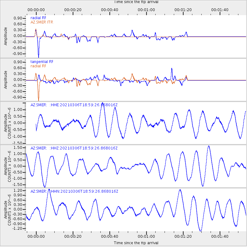
SMER AZ.SMER - Earthquake Result Viewer
*The percent match for this event was below the threshold and hence no stack was calculated.
| Earthquake location: |
Southeast Of Loyalty Islands |
| Earthquake latitude/longitude: |
-22.6/171.8 |
| Earthquake time(UTC): |
2021/03/06 (065) 18:47:12 GMT |
| Earthquake Depth: |
29 km |
| Earthquake Magnitude: |
5.1 Mww |
| Earthquake Catalog/Contributor: |
NEIC PDE/us |
|
| Network: |
AZ ANZA Regional Network |
| Station: |
SMER AZ.SMER |
| Lat/Lon: |
33.46 N/117.17 W |
| Elevation: |
355 m |
|
| Distance: |
87.7 deg |
| Az: |
52.317 deg |
| Baz: |
241.003 deg |
| Ray Param: |
$rayparam |
*The percent match for this event was below the threshold and hence was not used in the summary stack. |
|
| Radial Match: |
84.16847 % |
| Radial Bump: |
400 |
| Transverse Match: |
68.39133 % |
| Transverse Bump: |
400 |
| SOD ConfigId: |
23341671 |
| Insert Time: |
2021-03-20 19:51:14.157 +0000 |
| GWidth: |
2.5 |
| Max Bumps: |
400 |
| Tol: |
0.001 |
|
Signal To Noise
| Channel | StoN | STA | LTA |
| AZ:SMER: :HHZ:20210306T18:59:26.868016Z | 1.558757 | 9.850465E-7 | 6.3194364E-7 |
| AZ:SMER: :HHN:20210306T18:59:26.868016Z | 0.6106869 | 3.789838E-7 | 6.205861E-7 |
| AZ:SMER: :HHE:20210306T18:59:26.868016Z | 2.4237106 | 6.2901347E-7 | 2.59525E-7 |
| Arrivals |
| Ps | |
| PpPs | |
| PsPs/PpSs | |


