You are here: Home > Network List > US - United States National Seismic Network Stations List
> Station HLID Hailey, Idaho, USA > Earthquake Result Viewer
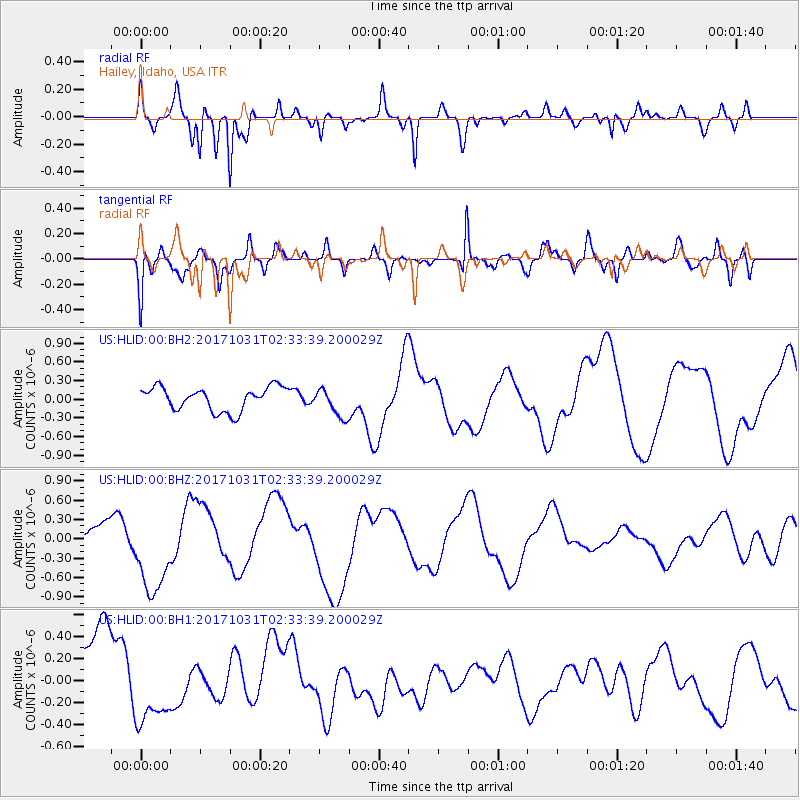
HLID Hailey, Idaho, USA - Earthquake Result Viewer
*The percent match for this event was below the threshold and hence no stack was calculated.
| Earthquake location: |
Loyalty Islands |
| Earthquake latitude/longitude: |
-21.5/168.9 |
| Earthquake time(UTC): |
2017/10/31 (304) 02:20:46 GMT |
| Earthquake Depth: |
10 km |
| Earthquake Magnitude: |
5.9 Mww |
| Earthquake Catalog/Contributor: |
NEIC PDE/us |
|
| Network: |
US United States National Seismic Network |
| Station: |
HLID Hailey, Idaho, USA |
| Lat/Lon: |
43.56 N/114.41 W |
| Elevation: |
1772 m |
|
| Distance: |
95.4 deg |
| Az: |
45.28 deg |
| Baz: |
245.57 deg |
| Ray Param: |
$rayparam |
*The percent match for this event was below the threshold and hence was not used in the summary stack. |
|
| Radial Match: |
81.63283 % |
| Radial Bump: |
349 |
| Transverse Match: |
62.182957 % |
| Transverse Bump: |
400 |
| SOD ConfigId: |
2429771 |
| Insert Time: |
2017-11-14 02:22:02.253 +0000 |
| GWidth: |
2.5 |
| Max Bumps: |
400 |
| Tol: |
0.001 |
|
Signal To Noise
| Channel | StoN | STA | LTA |
| US:HLID:00:BHZ:20171031T02:33:39.200029Z | 3.2829256 | 6.854656E-7 | 2.0879718E-7 |
| US:HLID:00:BH1:20171031T02:33:39.200029Z | 0.786511 | 3.091706E-7 | 3.9309123E-7 |
| US:HLID:00:BH2:20171031T02:33:39.200029Z | 1.2328128 | 2.3183134E-7 | 1.8805072E-7 |
| Arrivals |
| Ps | |
| PpPs | |
| PsPs/PpSs | |


