You are here: Home > Network List > UW - Pacific Northwest Regional Seismic Network Stations List
> Station HOOD Mt Hood Meadows, OR CREST BB SMO > Earthquake Result Viewer
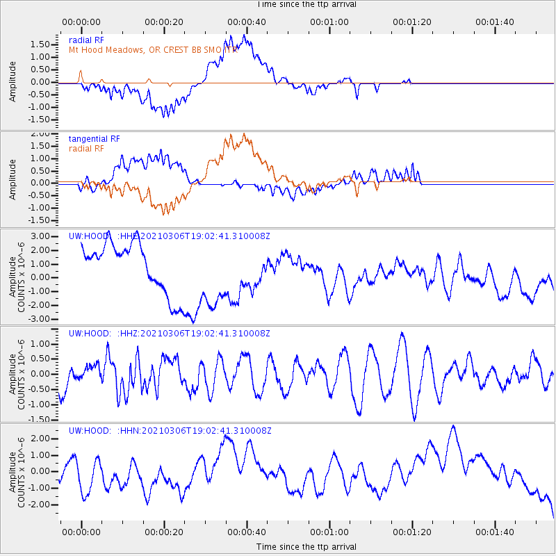
HOOD Mt Hood Meadows, OR CREST BB SMO - Earthquake Result Viewer
*The percent match for this event was below the threshold and hence no stack was calculated.
| Earthquake location: |
Mariana Islands |
| Earthquake latitude/longitude: |
20.9/144.3 |
| Earthquake time(UTC): |
2021/03/06 (065) 18:51:13 GMT |
| Earthquake Depth: |
10 km |
| Earthquake Magnitude: |
5.7 Mww |
| Earthquake Catalog/Contributor: |
NEIC PDE/us |
|
| Network: |
UW Pacific Northwest Regional Seismic Network |
| Station: |
HOOD Mt Hood Meadows, OR CREST BB SMO |
| Lat/Lon: |
45.32 N/121.65 W |
| Elevation: |
1520 m |
|
| Distance: |
78.2 deg |
| Az: |
45.973 deg |
| Baz: |
287.643 deg |
| Ray Param: |
$rayparam |
*The percent match for this event was below the threshold and hence was not used in the summary stack. |
|
| Radial Match: |
62.35665 % |
| Radial Bump: |
400 |
| Transverse Match: |
41.942513 % |
| Transverse Bump: |
400 |
| SOD ConfigId: |
23341671 |
| Insert Time: |
2021-03-20 20:13:13.444 +0000 |
| GWidth: |
2.5 |
| Max Bumps: |
400 |
| Tol: |
0.001 |
|
Signal To Noise
| Channel | StoN | STA | LTA |
| UW:HOOD: :HHZ:20210306T19:02:41.310008Z | 0.8991991 | 2.3516324E-7 | 2.615252E-7 |
| UW:HOOD: :HHN:20210306T19:02:41.310008Z | 2.3064694 | 1.3149966E-6 | 5.70134E-7 |
| UW:HOOD: :HHE:20210306T19:02:41.310008Z | 1.4145867 | 2.5370493E-6 | 1.7934915E-6 |
| Arrivals |
| Ps | |
| PpPs | |
| PsPs/PpSs | |


