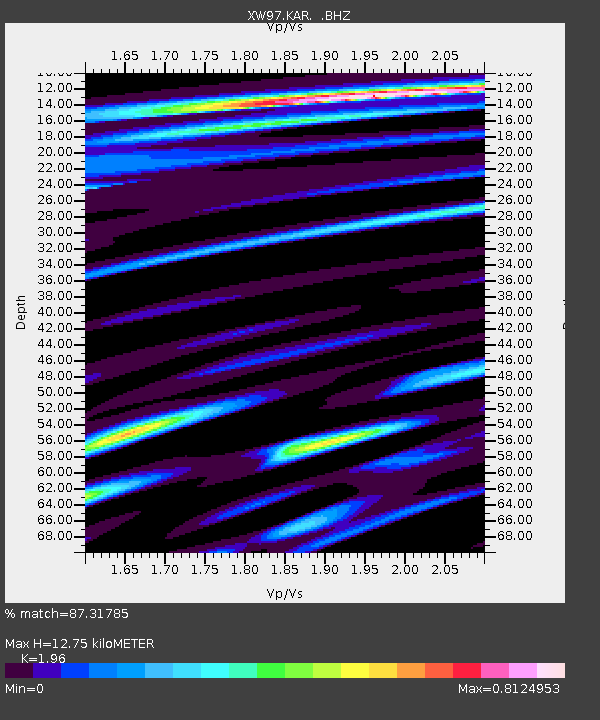
KAR XW.KAR - Earthquake Result Viewer

Earthquake location: Rat Islands, Aleutian Islands
Earthquake latitude/longitude: 51.6/175.2
Earthquake time(UTC): 1998/08/20 (232) 15:00:08 GMT
Earthquake Depth: 33 km
Earthquake Magnitude: 5.6 MB, 6.0 MS, 6.2 UNKNOWN, 6.2 MW
Earthquake Catalog/Contributor: WHDF/NEIC
Network: XW Tien Shan Continental Dynamics
Station: KAR XW.KAR
Lat/Lon: 42.47 N/78.40 E
Elevation: 1778 m
Distance: 61.9 deg
Az: 303.62 deg
Baz: 44.566 deg
Ray Param: 0.0605268
Estimated Moho Depth: 12.75 km
Estimated Crust Vp/Vs: 1.96
Assumed Crust Vp: 6.306 km/s
Estimated Crust Vs: 3.217 km/s
Estimated Crust Poisson's Ratio: 0.32
Radial Match: 87.31785 %
Radial Bump: 400
Transverse Match: 90.84735 %
Transverse Bump: 400
SOD ConfigId: 4480
Insert Time: 2010-02-26 15:24:30.073 +0000
GWidth: 2.5
Max Bumps: 400
Tol: 0.001

Signal To Noise

ChannelStoNSTALTA
XW:KAR: :BHZ:19980820T15:09:53.550012Z11.2279211.8396719E-61.6384796E-7
XW:KAR: :BHN:19980820T15:09:53.550012Z5.46771536.5447546E-71.1969816E-7
XW:KAR: :BHE:19980820T15:09:53.550012Z2.80694063.6843514E-71.3125862E-7
Arrivals
Ps2.0 SECOND
PpPs5.8 SECOND
PsPs/PpSs7.8 SECOND