You are here: Home > Network List > AV - Alaska Volcano Observatory Stations List
> Station SPCR Ckakachatna River, Mount Spurr, Alaska > Earthquake Result Viewer
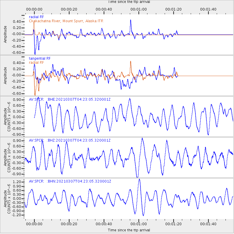
SPCR Ckakachatna River, Mount Spurr, Alaska - Earthquake Result Viewer
*The percent match for this event was below the threshold and hence no stack was calculated.
| Earthquake location: |
Kermadec Islands Region |
| Earthquake latitude/longitude: |
-29.2/-176.5 |
| Earthquake time(UTC): |
2021/03/07 (066) 04:10:26 GMT |
| Earthquake Depth: |
10 km |
| Earthquake Magnitude: |
5.5 mb |
| Earthquake Catalog/Contributor: |
NEIC PDE/us |
|
| Network: |
AV Alaska Volcano Observatory |
| Station: |
SPCR Ckakachatna River, Mount Spurr, Alaska |
| Lat/Lon: |
61.20 N/152.21 W |
| Elevation: |
984 m |
|
| Distance: |
92.2 deg |
| Az: |
11.518 deg |
| Baz: |
201.128 deg |
| Ray Param: |
$rayparam |
*The percent match for this event was below the threshold and hence was not used in the summary stack. |
|
| Radial Match: |
54.32423 % |
| Radial Bump: |
400 |
| Transverse Match: |
51.934963 % |
| Transverse Bump: |
400 |
| SOD ConfigId: |
23341671 |
| Insert Time: |
2021-03-21 05:14:37.655 +0000 |
| GWidth: |
2.5 |
| Max Bumps: |
400 |
| Tol: |
0.001 |
|
Signal To Noise
| Channel | StoN | STA | LTA |
| AV:SPCR: :BHZ:20210307T04:23:05.320001Z | 1.6278242 | 5.3934133E-7 | 3.3132653E-7 |
| AV:SPCR: :BHN:20210307T04:23:05.320001Z | 1.0386707 | 2.8609344E-7 | 2.7544192E-7 |
| AV:SPCR: :BHE:20210307T04:23:05.320001Z | 0.7805306 | 3.8297966E-7 | 4.906658E-7 |
| Arrivals |
| Ps | |
| PpPs | |
| PsPs/PpSs | |


