You are here: Home > Network List > TA - USArray Transportable Network (new EarthScope stations) Stations List
> Station M31M Drury Creek, Yukon, CA > Earthquake Result Viewer
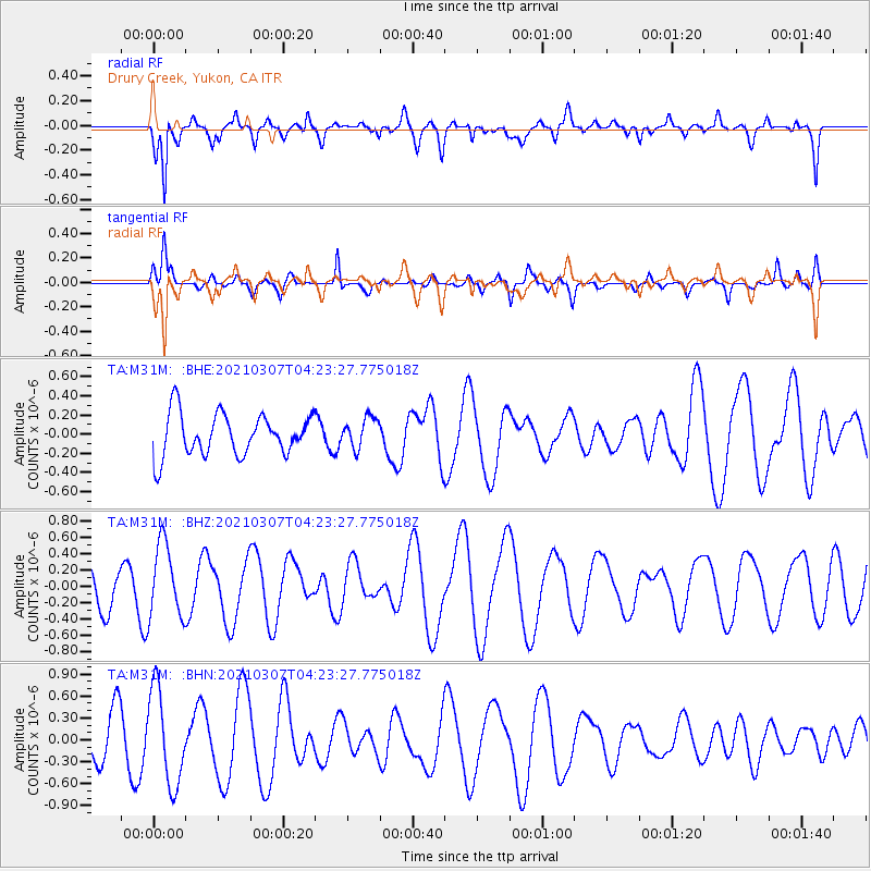
M31M Drury Creek, Yukon, CA - Earthquake Result Viewer
*The percent match for this event was below the threshold and hence no stack was calculated.
| Earthquake location: |
Kermadec Islands Region |
| Earthquake latitude/longitude: |
-29.2/-176.5 |
| Earthquake time(UTC): |
2021/03/07 (066) 04:10:26 GMT |
| Earthquake Depth: |
10 km |
| Earthquake Magnitude: |
5.5 mb |
| Earthquake Catalog/Contributor: |
NEIC PDE/us |
|
| Network: |
TA USArray Transportable Network (new EarthScope stations) |
| Station: |
M31M Drury Creek, Yukon, CA |
| Lat/Lon: |
62.20 N/134.39 W |
| Elevation: |
639 m |
|
| Distance: |
97.2 deg |
| Az: |
18.488 deg |
| Baz: |
216.248 deg |
| Ray Param: |
$rayparam |
*The percent match for this event was below the threshold and hence was not used in the summary stack. |
|
| Radial Match: |
82.4348 % |
| Radial Bump: |
400 |
| Transverse Match: |
45.757412 % |
| Transverse Bump: |
243 |
| SOD ConfigId: |
23341671 |
| Insert Time: |
2021-03-21 05:23:18.179 +0000 |
| GWidth: |
2.5 |
| Max Bumps: |
400 |
| Tol: |
0.001 |
|
Signal To Noise
| Channel | StoN | STA | LTA |
| TA:M31M: :BHZ:20210307T04:23:27.775018Z | 1.3131281 | 4.5433725E-7 | 3.4599614E-7 |
| TA:M31M: :BHN:20210307T04:23:27.775018Z | 2.9769075 | 6.4679193E-7 | 2.1726976E-7 |
| TA:M31M: :BHE:20210307T04:23:27.775018Z | 0.71942127 | 1.5744511E-7 | 2.1884968E-7 |
| Arrivals |
| Ps | |
| PpPs | |
| PsPs/PpSs | |


