You are here: Home > Network List > IW - Intermountain West Stations List
> Station IMW Indian Meadow, Wyoming, USA > Earthquake Result Viewer
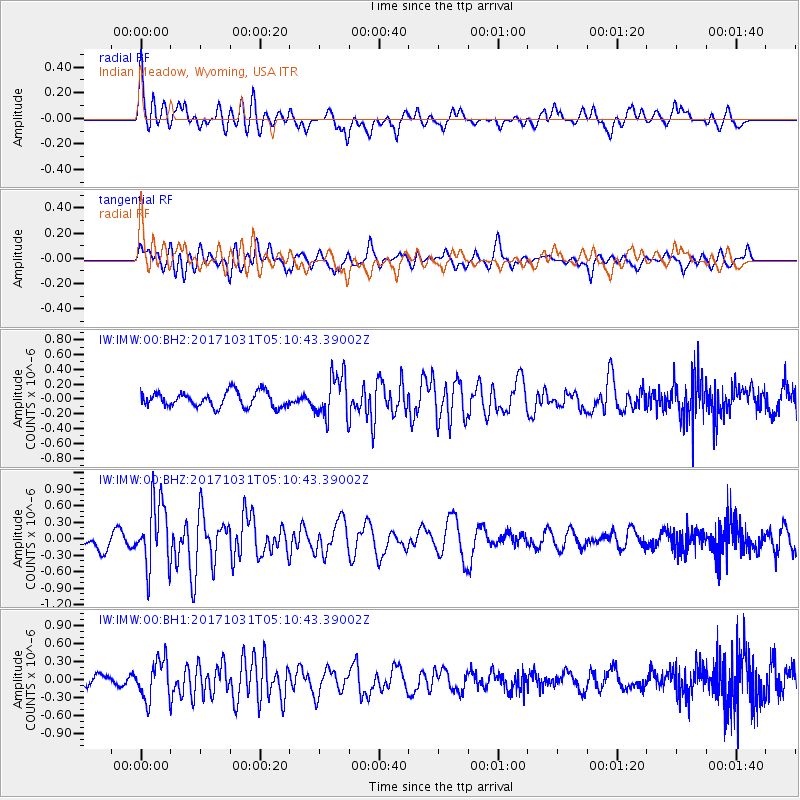
IMW Indian Meadow, Wyoming, USA - Earthquake Result Viewer
*The percent match for this event was below the threshold and hence no stack was calculated.
| Earthquake location: |
Tonga Islands |
| Earthquake latitude/longitude: |
-15.5/-173.3 |
| Earthquake time(UTC): |
2017/10/31 (304) 04:58:58 GMT |
| Earthquake Depth: |
35 km |
| Earthquake Magnitude: |
5.8 mb |
| Earthquake Catalog/Contributor: |
NEIC PDE/us |
|
| Network: |
IW Intermountain West |
| Station: |
IMW Indian Meadow, Wyoming, USA |
| Lat/Lon: |
43.90 N/110.94 W |
| Elevation: |
2646 m |
|
| Distance: |
82.0 deg |
| Az: |
40.303 deg |
| Baz: |
239.599 deg |
| Ray Param: |
$rayparam |
*The percent match for this event was below the threshold and hence was not used in the summary stack. |
|
| Radial Match: |
73.71447 % |
| Radial Bump: |
400 |
| Transverse Match: |
63.525578 % |
| Transverse Bump: |
400 |
| SOD ConfigId: |
2429771 |
| Insert Time: |
2017-11-14 05:01:08.376 +0000 |
| GWidth: |
2.5 |
| Max Bumps: |
400 |
| Tol: |
0.001 |
|
Signal To Noise
| Channel | StoN | STA | LTA |
| IW:IMW:00:BHZ:20171031T05:10:43.39002Z | 3.7716336 | 6.036025E-7 | 1.6003742E-7 |
| IW:IMW:00:BH1:20171031T05:10:43.39002Z | 2.123004 | 3.2984968E-7 | 1.5536932E-7 |
| IW:IMW:00:BH2:20171031T05:10:43.39002Z | 2.9092607 | 2.9415392E-7 | 1.0110951E-7 |
| Arrivals |
| Ps | |
| PpPs | |
| PsPs/PpSs | |


