KAR XW.KAR - Earthquake Result Viewer
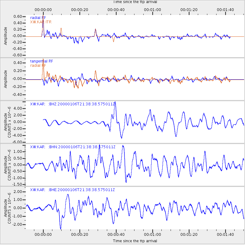
Earthquake location: Luzon, Philippines
Earthquake latitude/longitude: 16.1/119.5
Earthquake time(UTC): 2000/01/06 (006) 21:31:06 GMT
Earthquake Depth: 33 km
Earthquake Magnitude: 5.8 MB, 5.9 MS, 6.3 MW, 6.2 MW
Earthquake Catalog/Contributor: WHDF/NEIC
Network: XW Tien Shan Continental Dynamics
Station: KAR XW.KAR
Lat/Lon: 42.47 N/78.40 E
Elevation: 1778 m
Distance: 43.8 deg
Az: 315.404 deg
Baz: 114.18 deg
Ray Param: 0.07223094
Estimated Moho Depth: 14.5 km
Estimated Crust Vp/Vs: 1.90
Assumed Crust Vp: 6.306 km/s
Estimated Crust Vs: 3.319 km/s
Estimated Crust Poisson's Ratio: 0.31
Radial Match: 86.3699 %
Radial Bump: 400
Transverse Match: 77.66241 %
Transverse Bump: 400
SOD ConfigId: 3744
Insert Time: 2010-02-26 15:24:49.964 +0000
GWidth: 2.5
Max Bumps: 400
Tol: 0.001

Signal To Noise

ChannelStoNSTALTA
XW:KAR: :BHN:20000106T21:38:38.575011Z1.16674512.2213463E-71.9038832E-7
XW:KAR: :BHE:20000106T21:38:38.575011Z0.80614042.867132E-73.5566163E-7
XW:KAR: :BHZ:20000106T21:38:38.575011Z1.03242994.7114293E-74.563437E-7
Arrivals
Ps2.2 SECOND
PpPs6.3 SECOND
PsPs/PpSs8.5 SECOND