You are here: Home > Network List > TX - Texas Seismological Network Stations List
> Station WTFS Witchita Falls > Earthquake Result Viewer
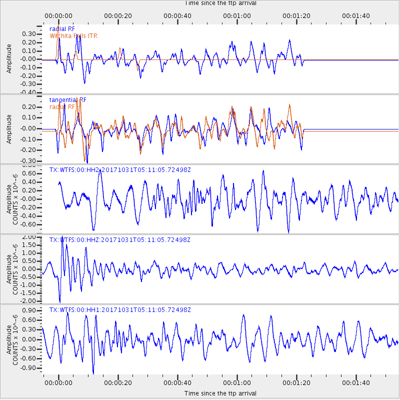
WTFS Witchita Falls - Earthquake Result Viewer
*The percent match for this event was below the threshold and hence no stack was calculated.
| Earthquake location: |
Tonga Islands |
| Earthquake latitude/longitude: |
-15.5/-173.3 |
| Earthquake time(UTC): |
2017/10/31 (304) 04:58:58 GMT |
| Earthquake Depth: |
35 km |
| Earthquake Magnitude: |
5.8 mb |
| Earthquake Catalog/Contributor: |
NEIC PDE/us |
|
| Network: |
TX Texas Seismological Network |
| Station: |
WTFS Witchita Falls |
| Lat/Lon: |
33.77 N/98.46 W |
| Elevation: |
277 m |
|
| Distance: |
86.4 deg |
| Az: |
53.676 deg |
| Baz: |
248.796 deg |
| Ray Param: |
$rayparam |
*The percent match for this event was below the threshold and hence was not used in the summary stack. |
|
| Radial Match: |
63.63378 % |
| Radial Bump: |
400 |
| Transverse Match: |
59.08214 % |
| Transverse Bump: |
341 |
| SOD ConfigId: |
2429771 |
| Insert Time: |
2017-11-14 05:02:40.880 +0000 |
| GWidth: |
2.5 |
| Max Bumps: |
400 |
| Tol: |
0.001 |
|
Signal To Noise
| Channel | StoN | STA | LTA |
| TX:WTFS:00:HHZ:20171031T05:11:05.72498Z | 6.2155094 | 1.0563231E-6 | 1.6994956E-7 |
| TX:WTFS:00:HH1:20171031T05:11:05.72498Z | 1.6573029 | 4.0243938E-7 | 2.428279E-7 |
| TX:WTFS:00:HH2:20171031T05:11:05.72498Z | 0.8702764 | 2.2799135E-7 | 2.619758E-7 |
| Arrivals |
| Ps | |
| PpPs | |
| PsPs/PpSs | |


