You are here: Home > Network List > CI - Caltech Regional Seismic Network Stations List
> Station BFS Mt Baldy Forest Station > Earthquake Result Viewer
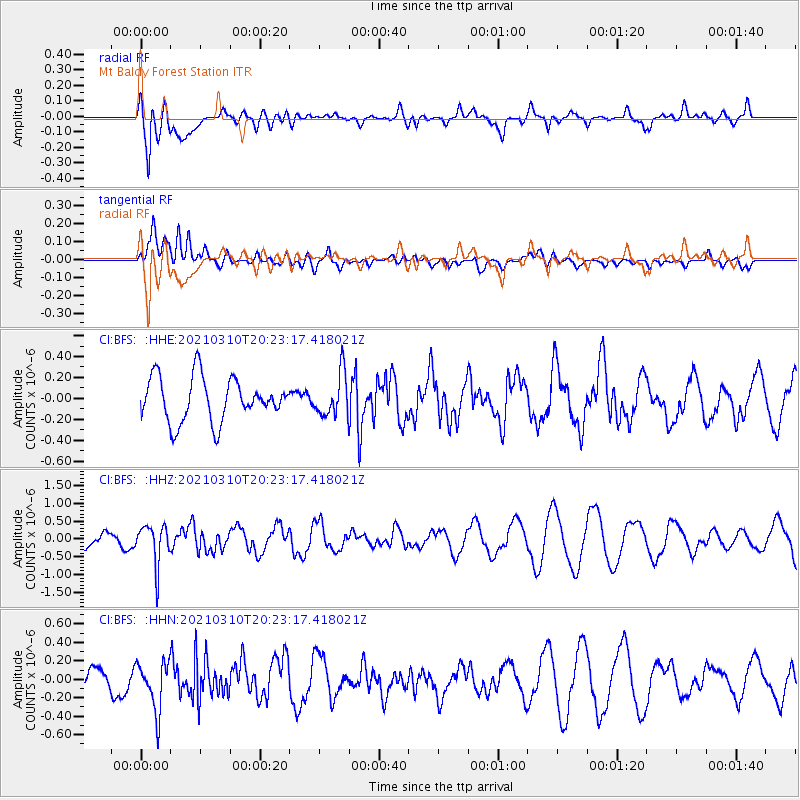
BFS Mt Baldy Forest Station - Earthquake Result Viewer
*The percent match for this event was below the threshold and hence no stack was calculated.
| Earthquake location: |
Fiji Islands Region |
| Earthquake latitude/longitude: |
-20.1/-177.7 |
| Earthquake time(UTC): |
2021/03/10 (069) 20:12:37 GMT |
| Earthquake Depth: |
488 km |
| Earthquake Magnitude: |
5.8 Mww |
| Earthquake Catalog/Contributor: |
NEIC PDE/us |
|
| Network: |
CI Caltech Regional Seismic Network |
| Station: |
BFS Mt Baldy Forest Station |
| Lat/Lon: |
34.24 N/117.66 W |
| Elevation: |
1312 m |
|
| Distance: |
78.6 deg |
| Az: |
47.052 deg |
| Baz: |
236.121 deg |
| Ray Param: |
$rayparam |
*The percent match for this event was below the threshold and hence was not used in the summary stack. |
|
| Radial Match: |
66.29138 % |
| Radial Bump: |
400 |
| Transverse Match: |
36.098164 % |
| Transverse Bump: |
400 |
| SOD ConfigId: |
24334971 |
| Insert Time: |
2021-03-24 20:25:53.526 +0000 |
| GWidth: |
2.5 |
| Max Bumps: |
400 |
| Tol: |
0.001 |
|
Signal To Noise
| Channel | StoN | STA | LTA |
| CI:BFS: :HHZ:20210310T20:23:17.418021Z | 1.4796228 | 5.543298E-7 | 3.7464264E-7 |
| CI:BFS: :HHN:20210310T20:23:17.418021Z | 1.1599151 | 2.7164762E-7 | 2.3419614E-7 |
| CI:BFS: :HHE:20210310T20:23:17.418021Z | 0.9771239 | 2.0314147E-7 | 2.0789734E-7 |
| Arrivals |
| Ps | |
| PpPs | |
| PsPs/PpSs | |


