You are here: Home > Network List > IU - Global Seismograph Network (GSN - IRIS/USGS) Stations List
> Station PMG Port Moresby, New Guinea > Earthquake Result Viewer
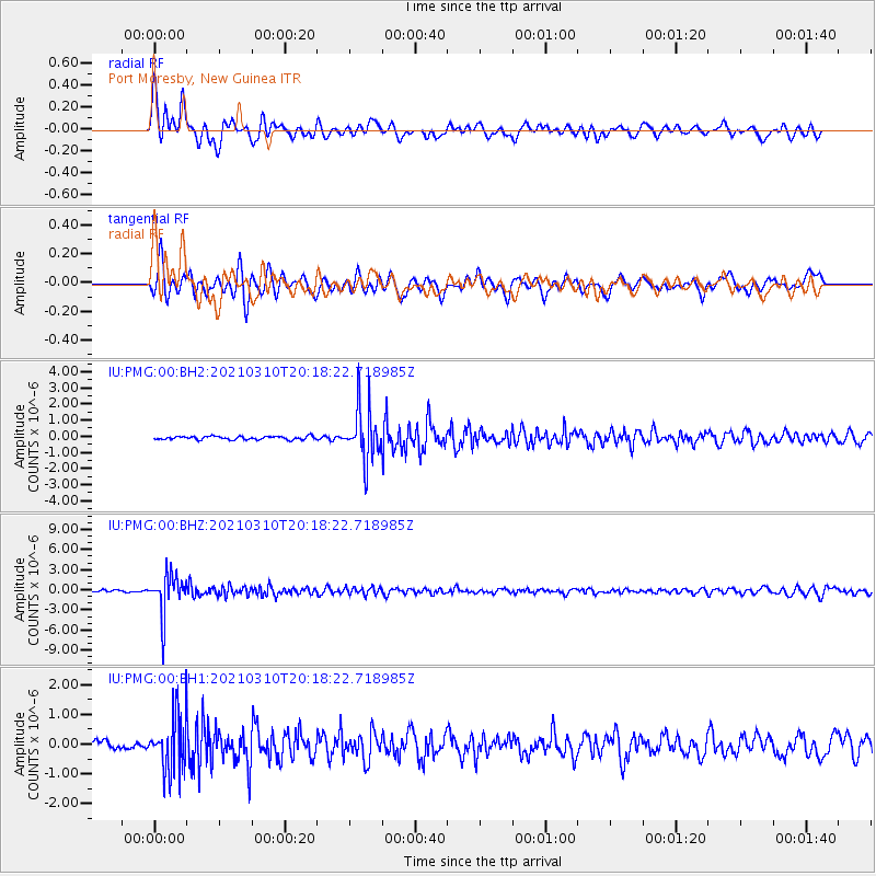
PMG Port Moresby, New Guinea - Earthquake Result Viewer
*The percent match for this event was below the threshold and hence no stack was calculated.
| Earthquake location: |
Fiji Islands Region |
| Earthquake latitude/longitude: |
-20.1/-177.7 |
| Earthquake time(UTC): |
2021/03/10 (069) 20:12:37 GMT |
| Earthquake Depth: |
488 km |
| Earthquake Magnitude: |
5.8 Mww |
| Earthquake Catalog/Contributor: |
NEIC PDE/us |
|
| Network: |
IU Global Seismograph Network (GSN - IRIS/USGS) |
| Station: |
PMG Port Moresby, New Guinea |
| Lat/Lon: |
9.40 S/147.16 E |
| Elevation: |
90 m |
|
| Distance: |
35.6 deg |
| Az: |
282.256 deg |
| Baz: |
111.477 deg |
| Ray Param: |
$rayparam |
*The percent match for this event was below the threshold and hence was not used in the summary stack. |
|
| Radial Match: |
80.86085 % |
| Radial Bump: |
400 |
| Transverse Match: |
74.11797 % |
| Transverse Bump: |
400 |
| SOD ConfigId: |
24334971 |
| Insert Time: |
2021-03-24 20:30:24.747 +0000 |
| GWidth: |
2.5 |
| Max Bumps: |
400 |
| Tol: |
0.001 |
|
Signal To Noise
| Channel | StoN | STA | LTA |
| IU:PMG:00:BHZ:20210310T20:18:22.718985Z | 18.118063 | 2.945086E-6 | 1.6254971E-7 |
| IU:PMG:00:BH1:20210310T20:18:22.718985Z | 8.011957 | 9.574346E-7 | 1.1950073E-7 |
| IU:PMG:00:BH2:20210310T20:18:22.718985Z | 15.723285 | 1.623573E-6 | 1.0325915E-7 |
| Arrivals |
| Ps | |
| PpPs | |
| PsPs/PpSs | |


