You are here: Home > Network List > IU - Global Seismograph Network (GSN - IRIS/USGS) Stations List
> Station RSSD Black Hills, South Dakota, USA > Earthquake Result Viewer
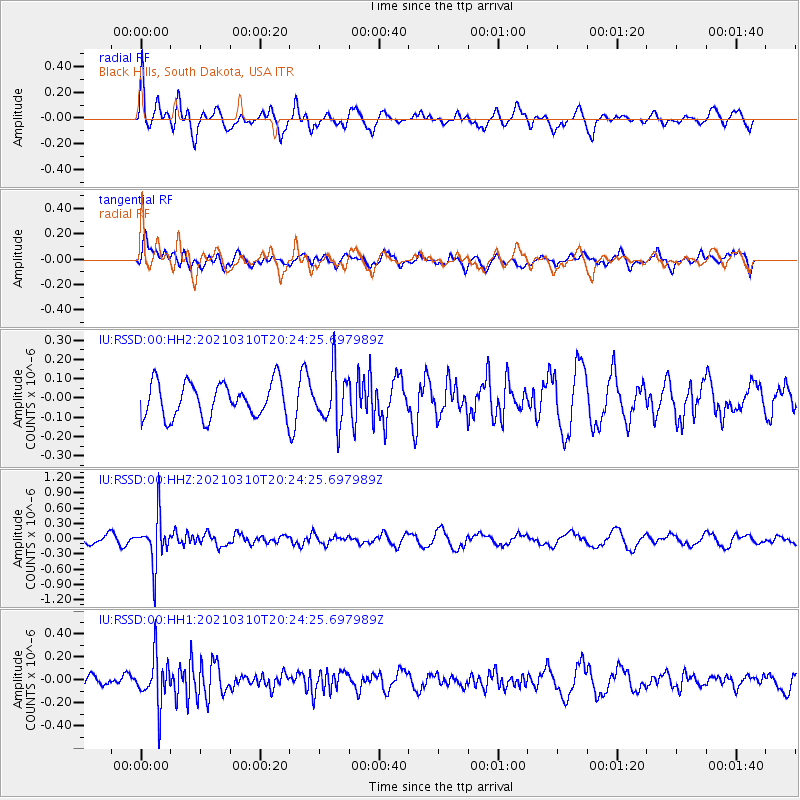
RSSD Black Hills, South Dakota, USA - Earthquake Result Viewer
*The percent match for this event was below the threshold and hence no stack was calculated.
| Earthquake location: |
Fiji Islands Region |
| Earthquake latitude/longitude: |
-20.1/-177.7 |
| Earthquake time(UTC): |
2021/03/10 (069) 20:12:37 GMT |
| Earthquake Depth: |
488 km |
| Earthquake Magnitude: |
5.8 Mww |
| Earthquake Catalog/Contributor: |
NEIC PDE/us |
|
| Network: |
IU Global Seismograph Network (GSN - IRIS/USGS) |
| Station: |
RSSD Black Hills, South Dakota, USA |
| Lat/Lon: |
44.12 N/104.04 W |
| Elevation: |
2090 m |
|
| Distance: |
92.7 deg |
| Az: |
43.772 deg |
| Baz: |
244.498 deg |
| Ray Param: |
$rayparam |
*The percent match for this event was below the threshold and hence was not used in the summary stack. |
|
| Radial Match: |
69.33858 % |
| Radial Bump: |
400 |
| Transverse Match: |
51.930122 % |
| Transverse Bump: |
400 |
| SOD ConfigId: |
24334971 |
| Insert Time: |
2021-03-24 20:30:30.326 +0000 |
| GWidth: |
2.5 |
| Max Bumps: |
400 |
| Tol: |
0.001 |
|
Signal To Noise
| Channel | StoN | STA | LTA |
| IU:RSSD:00:HHZ:20210310T20:24:25.697989Z | 4.575487 | 4.795529E-7 | 1.04809146E-7 |
| IU:RSSD:00:HH1:20210310T20:24:25.697989Z | 3.5251312 | 2.0723836E-7 | 5.8788835E-8 |
| IU:RSSD:00:HH2:20210310T20:24:25.697989Z | 1.5074296 | 1.3506786E-7 | 8.960145E-8 |
| Arrivals |
| Ps | |
| PpPs | |
| PsPs/PpSs | |


