You are here: Home > Network List > US - United States National Seismic Network Stations List
> Station EGMT Eagleton, Montana, USA > Earthquake Result Viewer
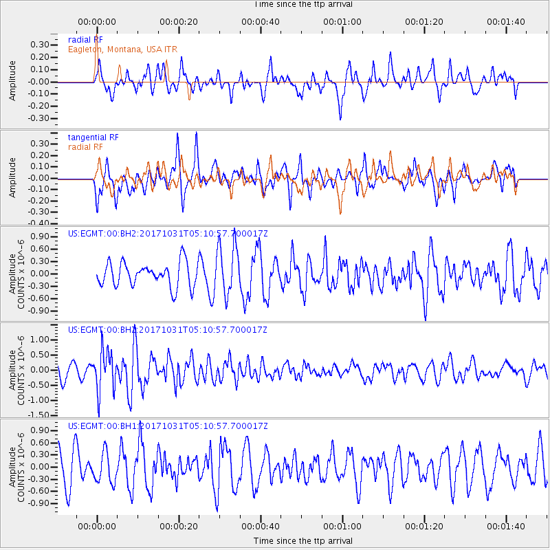
EGMT Eagleton, Montana, USA - Earthquake Result Viewer
*The percent match for this event was below the threshold and hence no stack was calculated.
| Earthquake location: |
Tonga Islands |
| Earthquake latitude/longitude: |
-15.5/-173.3 |
| Earthquake time(UTC): |
2017/10/31 (304) 04:58:58 GMT |
| Earthquake Depth: |
35 km |
| Earthquake Magnitude: |
5.8 mb |
| Earthquake Catalog/Contributor: |
NEIC PDE/us |
|
| Network: |
US United States National Seismic Network |
| Station: |
EGMT Eagleton, Montana, USA |
| Lat/Lon: |
48.02 N/109.75 W |
| Elevation: |
1055 m |
|
| Distance: |
84.8 deg |
| Az: |
37.129 deg |
| Baz: |
240.083 deg |
| Ray Param: |
$rayparam |
*The percent match for this event was below the threshold and hence was not used in the summary stack. |
|
| Radial Match: |
52.089592 % |
| Radial Bump: |
400 |
| Transverse Match: |
61.708004 % |
| Transverse Bump: |
400 |
| SOD ConfigId: |
2429771 |
| Insert Time: |
2017-11-14 05:03:12.557 +0000 |
| GWidth: |
2.5 |
| Max Bumps: |
400 |
| Tol: |
0.001 |
|
Signal To Noise
| Channel | StoN | STA | LTA |
| US:EGMT:00:BHZ:20171031T05:10:57.700017Z | 2.6983483 | 6.706999E-7 | 2.4855942E-7 |
| US:EGMT:00:BH1:20171031T05:10:57.700017Z | 1.0301836 | 3.7403225E-7 | 3.630734E-7 |
| US:EGMT:00:BH2:20171031T05:10:57.700017Z | 2.1041663 | 6.081298E-7 | 2.8901226E-7 |
| Arrivals |
| Ps | |
| PpPs | |
| PsPs/PpSs | |


