You are here: Home > Network List > US - United States National Seismic Network Stations List
> Station MVCO Mesa Verde, Colorado, USA > Earthquake Result Viewer
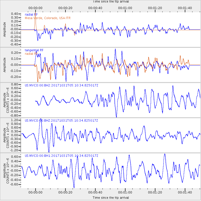
MVCO Mesa Verde, Colorado, USA - Earthquake Result Viewer
*The percent match for this event was below the threshold and hence no stack was calculated.
| Earthquake location: |
Tonga Islands |
| Earthquake latitude/longitude: |
-15.5/-173.3 |
| Earthquake time(UTC): |
2017/10/31 (304) 04:58:58 GMT |
| Earthquake Depth: |
35 km |
| Earthquake Magnitude: |
5.8 mb |
| Earthquake Catalog/Contributor: |
NEIC PDE/us |
|
| Network: |
US United States National Seismic Network |
| Station: |
MVCO Mesa Verde, Colorado, USA |
| Lat/Lon: |
37.21 N/108.50 W |
| Elevation: |
2170 m |
|
| Distance: |
80.4 deg |
| Az: |
47.124 deg |
| Baz: |
242.229 deg |
| Ray Param: |
$rayparam |
*The percent match for this event was below the threshold and hence was not used in the summary stack. |
|
| Radial Match: |
58.250984 % |
| Radial Bump: |
400 |
| Transverse Match: |
70.97807 % |
| Transverse Bump: |
400 |
| SOD ConfigId: |
2429771 |
| Insert Time: |
2017-11-14 05:03:33.305 +0000 |
| GWidth: |
2.5 |
| Max Bumps: |
400 |
| Tol: |
0.001 |
|
Signal To Noise
| Channel | StoN | STA | LTA |
| US:MVCO:00:BHZ:20171031T05:10:34.825017Z | 5.203944 | 7.6119824E-7 | 1.4627334E-7 |
| US:MVCO:00:BH1:20171031T05:10:34.825017Z | 0.7011747 | 1.556987E-7 | 2.220541E-7 |
| US:MVCO:00:BH2:20171031T05:10:34.825017Z | 1.7832694 | 2.2361782E-7 | 1.2539766E-7 |
| Arrivals |
| Ps | |
| PpPs | |
| PsPs/PpSs | |


