You are here: Home > Network List > TA - USArray Transportable Network (new EarthScope stations) Stations List
> Station M31M Drury Creek, Yukon, CA > Earthquake Result Viewer
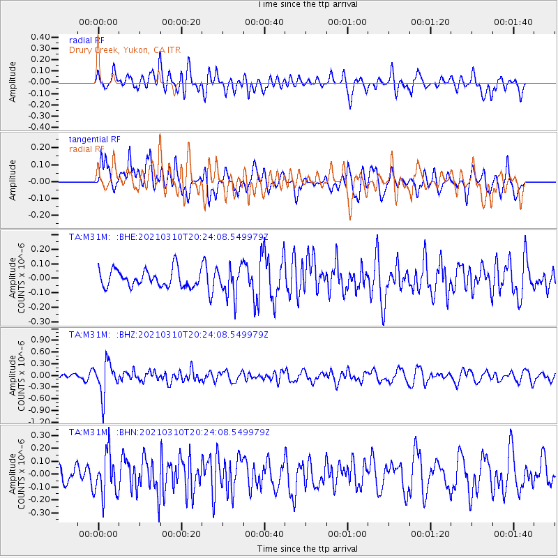
M31M Drury Creek, Yukon, CA - Earthquake Result Viewer
*The percent match for this event was below the threshold and hence no stack was calculated.
| Earthquake location: |
Fiji Islands Region |
| Earthquake latitude/longitude: |
-20.1/-177.7 |
| Earthquake time(UTC): |
2021/03/10 (069) 20:12:37 GMT |
| Earthquake Depth: |
488 km |
| Earthquake Magnitude: |
5.8 Mww |
| Earthquake Catalog/Contributor: |
NEIC PDE/us |
|
| Network: |
TA USArray Transportable Network (new EarthScope stations) |
| Station: |
M31M Drury Creek, Yukon, CA |
| Lat/Lon: |
62.20 N/134.39 W |
| Elevation: |
639 m |
|
| Distance: |
88.9 deg |
| Az: |
18.752 deg |
| Baz: |
220.115 deg |
| Ray Param: |
$rayparam |
*The percent match for this event was below the threshold and hence was not used in the summary stack. |
|
| Radial Match: |
59.44985 % |
| Radial Bump: |
400 |
| Transverse Match: |
62.423996 % |
| Transverse Bump: |
400 |
| SOD ConfigId: |
24334971 |
| Insert Time: |
2021-03-24 20:37:07.992 +0000 |
| GWidth: |
2.5 |
| Max Bumps: |
400 |
| Tol: |
0.001 |
|
Signal To Noise
| Channel | StoN | STA | LTA |
| TA:M31M: :BHZ:20210310T20:24:08.549979Z | 3.3595576 | 4.2684385E-7 | 1.270536E-7 |
| TA:M31M: :BHN:20210310T20:24:08.549979Z | 1.4750463 | 1.6353316E-7 | 1.1086646E-7 |
| TA:M31M: :BHE:20210310T20:24:08.549979Z | 1.7859758 | 1.03701964E-7 | 5.8064597E-8 |
| Arrivals |
| Ps | |
| PpPs | |
| PsPs/PpSs | |


