You are here: Home > Network List > TA - USArray Transportable Network (new EarthScope stations) Stations List
> Station R33M Jennings River, BC, CAN > Earthquake Result Viewer
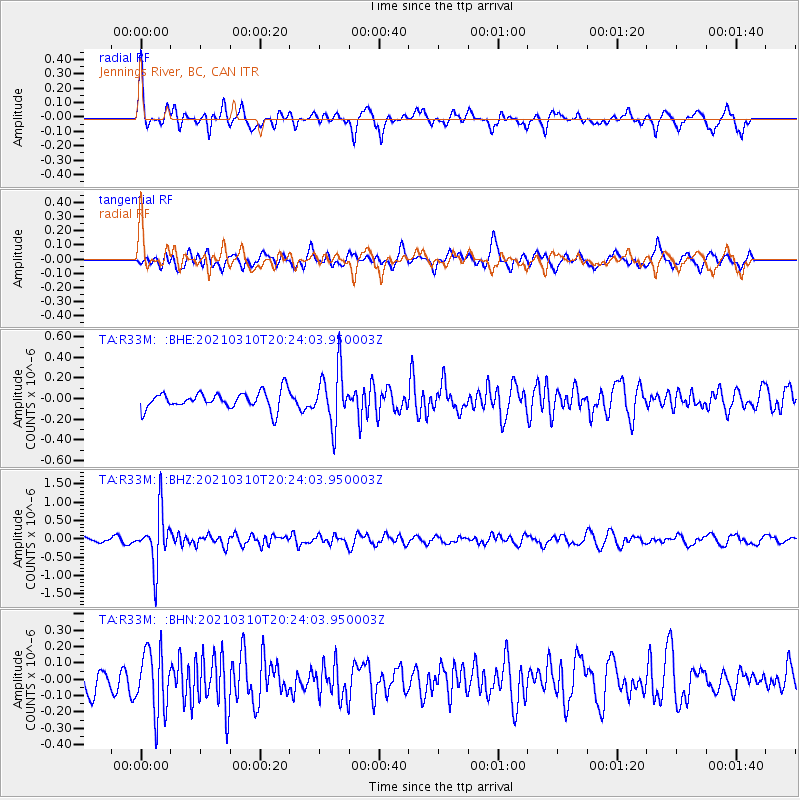
R33M Jennings River, BC, CAN - Earthquake Result Viewer
*The percent match for this event was below the threshold and hence no stack was calculated.
| Earthquake location: |
Fiji Islands Region |
| Earthquake latitude/longitude: |
-20.1/-177.7 |
| Earthquake time(UTC): |
2021/03/10 (069) 20:12:37 GMT |
| Earthquake Depth: |
488 km |
| Earthquake Magnitude: |
5.8 Mww |
| Earthquake Catalog/Contributor: |
NEIC PDE/us |
|
| Network: |
TA USArray Transportable Network (new EarthScope stations) |
| Station: |
R33M Jennings River, BC, CAN |
| Lat/Lon: |
59.39 N/130.97 W |
| Elevation: |
1437 m |
|
| Distance: |
88.0 deg |
| Az: |
21.879 deg |
| Baz: |
223.185 deg |
| Ray Param: |
$rayparam |
*The percent match for this event was below the threshold and hence was not used in the summary stack. |
|
| Radial Match: |
63.08921 % |
| Radial Bump: |
311 |
| Transverse Match: |
61.468 % |
| Transverse Bump: |
400 |
| SOD ConfigId: |
24334971 |
| Insert Time: |
2021-03-24 20:37:27.507 +0000 |
| GWidth: |
2.5 |
| Max Bumps: |
400 |
| Tol: |
0.001 |
|
Signal To Noise
| Channel | StoN | STA | LTA |
| TA:R33M: :BHZ:20210310T20:24:03.950003Z | 8.853869 | 7.3373633E-7 | 8.287183E-8 |
| TA:R33M: :BHN:20210310T20:24:03.950003Z | 1.8959899 | 1.9118477E-7 | 1.0083639E-7 |
| TA:R33M: :BHE:20210310T20:24:03.950003Z | 3.2016711 | 2.6595606E-7 | 8.306789E-8 |
| Arrivals |
| Ps | |
| PpPs | |
| PsPs/PpSs | |


