You are here: Home > Network List > TA - USArray Transportable Network (new EarthScope stations) Stations List
> Station R31K City Hall, Gustavus, AK, USA > Earthquake Result Viewer
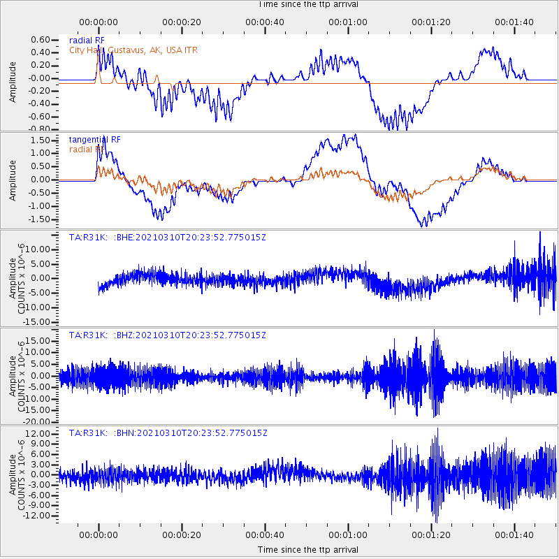
R31K City Hall, Gustavus, AK, USA - Earthquake Result Viewer
*The percent match for this event was below the threshold and hence no stack was calculated.
| Earthquake location: |
Fiji Islands Region |
| Earthquake latitude/longitude: |
-20.1/-177.7 |
| Earthquake time(UTC): |
2021/03/10 (069) 20:12:37 GMT |
| Earthquake Depth: |
488 km |
| Earthquake Magnitude: |
5.8 Mww |
| Earthquake Catalog/Contributor: |
NEIC PDE/us |
|
| Network: |
TA USArray Transportable Network (new EarthScope stations) |
| Station: |
R31K City Hall, Gustavus, AK, USA |
| Lat/Lon: |
58.41 N/135.74 W |
| Elevation: |
15 m |
|
| Distance: |
85.6 deg |
| Az: |
20.658 deg |
| Baz: |
219.036 deg |
| Ray Param: |
$rayparam |
*The percent match for this event was below the threshold and hence was not used in the summary stack. |
|
| Radial Match: |
29.34998 % |
| Radial Bump: |
400 |
| Transverse Match: |
27.275782 % |
| Transverse Bump: |
400 |
| SOD ConfigId: |
24334971 |
| Insert Time: |
2021-03-24 20:37:27.645 +0000 |
| GWidth: |
2.5 |
| Max Bumps: |
400 |
| Tol: |
0.001 |
|
Signal To Noise
| Channel | StoN | STA | LTA |
| TA:R31K: :BHZ:20210310T20:23:52.775015Z | 1.9327039 | 4.002235E-6 | 2.0707957E-6 |
| TA:R31K: :BHN:20210310T20:23:52.775015Z | 1.3764278 | 2.0218474E-6 | 1.4689092E-6 |
| TA:R31K: :BHE:20210310T20:23:52.775015Z | 0.7201539 | 1.4166887E-6 | 1.9672027E-6 |
| Arrivals |
| Ps | |
| PpPs | |
| PsPs/PpSs | |


