You are here: Home > Network List > US - United States National Seismic Network Stations List
> Station OGNE Ogallala, Nebraska, USA > Earthquake Result Viewer
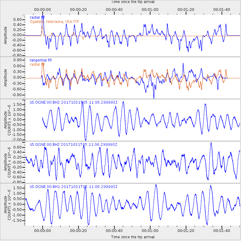
OGNE Ogallala, Nebraska, USA - Earthquake Result Viewer
*The percent match for this event was below the threshold and hence no stack was calculated.
| Earthquake location: |
Tonga Islands |
| Earthquake latitude/longitude: |
-15.5/-173.3 |
| Earthquake time(UTC): |
2017/10/31 (304) 04:58:58 GMT |
| Earthquake Depth: |
35 km |
| Earthquake Magnitude: |
5.8 mb |
| Earthquake Catalog/Contributor: |
NEIC PDE/us |
|
| Network: |
US United States National Seismic Network |
| Station: |
OGNE Ogallala, Nebraska, USA |
| Lat/Lon: |
40.95 N/102.03 W |
| Elevation: |
1054 m |
|
| Distance: |
86.5 deg |
| Az: |
45.955 deg |
| Baz: |
246.159 deg |
| Ray Param: |
$rayparam |
*The percent match for this event was below the threshold and hence was not used in the summary stack. |
|
| Radial Match: |
61.50517 % |
| Radial Bump: |
400 |
| Transverse Match: |
49.59771 % |
| Transverse Bump: |
400 |
| SOD ConfigId: |
2429771 |
| Insert Time: |
2017-11-14 05:03:37.919 +0000 |
| GWidth: |
2.5 |
| Max Bumps: |
400 |
| Tol: |
0.001 |
|
Signal To Noise
| Channel | StoN | STA | LTA |
| US:OGNE:00:BHZ:20171031T05:11:06.299993Z | 1.4472903 | 3.5197925E-7 | 2.431988E-7 |
| US:OGNE:00:BH1:20171031T05:11:06.299993Z | 1.9232662 | 1.1082983E-6 | 5.762584E-7 |
| US:OGNE:00:BH2:20171031T05:11:06.299993Z | 0.8145228 | 6.2158375E-7 | 7.631263E-7 |
| Arrivals |
| Ps | |
| PpPs | |
| PsPs/PpSs | |


