KAR XW.KAR - Earthquake Result Viewer
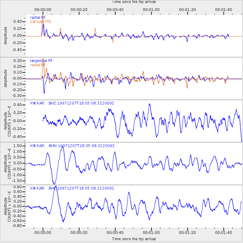
Earthquake location: Near East Coast Of Kamchatka
Earthquake latitude/longitude: 54.7/162.9
Earthquake time(UTC): 1997/12/07 (341) 17:56:18 GMT
Earthquake Depth: 33 km
Earthquake Magnitude: 5.6 MB, 6.0 MS, 6.3 UNKNOWN, 6.1 MW
Earthquake Catalog/Contributor: WHDF/NEIC
Network: XW Tien Shan Continental Dynamics
Station: KAR XW.KAR
Lat/Lon: 42.47 N/78.40 E
Elevation: 1778 m
Distance: 53.9 deg
Az: 294.332 deg
Baz: 45.692 deg
Ray Param: 0.065713525
Estimated Moho Depth: 65.75 km
Estimated Crust Vp/Vs: 1.89
Assumed Crust Vp: 6.306 km/s
Estimated Crust Vs: 3.341 km/s
Estimated Crust Poisson's Ratio: 0.30
Radial Match: 86.197334 %
Radial Bump: 400
Transverse Match: 81.84645 %
Transverse Bump: 367
SOD ConfigId: 4480
Insert Time: 2010-02-26 15:25:04.246 +0000
GWidth: 2.5
Max Bumps: 400
Tol: 0.001

Signal To Noise

ChannelStoNSTALTA
XW:KAR: :BHN:19971207T18:05:08.322009Z9.8608984.7177312E-74.7842814E-8
XW:KAR: :BHE:19971207T18:05:08.322009Z2.64139911.4875529E-75.6316853E-8
XW:KAR: :BHZ:19971207T18:05:08.322009Z1.77997881.0701089E-76.01192E-8
Arrivals
Ps9.7 SECOND
PpPs29 SECOND
PsPs/PpSs38 SECOND