You are here: Home > Network List > UW - Pacific Northwest Regional Seismic Network Stations List
> Station FISH Seaside, OR, USA > Earthquake Result Viewer
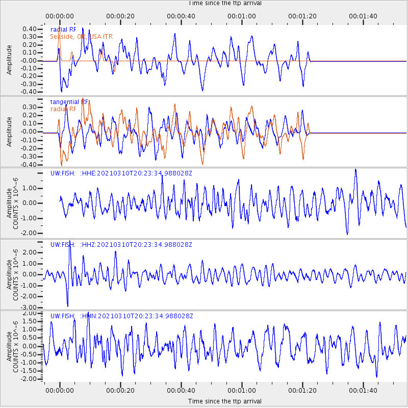
FISH Seaside, OR, USA - Earthquake Result Viewer
*The percent match for this event was below the threshold and hence no stack was calculated.
| Earthquake location: |
Fiji Islands Region |
| Earthquake latitude/longitude: |
-20.1/-177.7 |
| Earthquake time(UTC): |
2021/03/10 (069) 20:12:37 GMT |
| Earthquake Depth: |
488 km |
| Earthquake Magnitude: |
5.8 Mww |
| Earthquake Catalog/Contributor: |
NEIC PDE/us |
|
| Network: |
UW Pacific Northwest Regional Seismic Network |
| Station: |
FISH Seaside, OR, USA |
| Lat/Lon: |
45.93 N/123.56 W |
| Elevation: |
325 m |
|
| Distance: |
82.0 deg |
| Az: |
34.822 deg |
| Baz: |
230.245 deg |
| Ray Param: |
$rayparam |
*The percent match for this event was below the threshold and hence was not used in the summary stack. |
|
| Radial Match: |
46.269344 % |
| Radial Bump: |
400 |
| Transverse Match: |
55.65486 % |
| Transverse Bump: |
400 |
| SOD ConfigId: |
24334971 |
| Insert Time: |
2021-03-24 20:41:50.927 +0000 |
| GWidth: |
2.5 |
| Max Bumps: |
400 |
| Tol: |
0.001 |
|
Signal To Noise
| Channel | StoN | STA | LTA |
| UW:FISH: :HHZ:20210310T20:23:34.988028Z | 1.9817845 | 1.1783741E-6 | 5.9460257E-7 |
| UW:FISH: :HHN:20210310T20:23:34.988028Z | 0.8538114 | 5.3283276E-7 | 6.240638E-7 |
| UW:FISH: :HHE:20210310T20:23:34.988028Z | 1.5048118 | 7.168038E-7 | 4.7634117E-7 |
| Arrivals |
| Ps | |
| PpPs | |
| PsPs/PpSs | |


