You are here: Home > Network List > WY - Yellowstone Wyoming Seismic Network Stations List
> Station YHH Holmes Hill, YNP, WY, USA > Earthquake Result Viewer
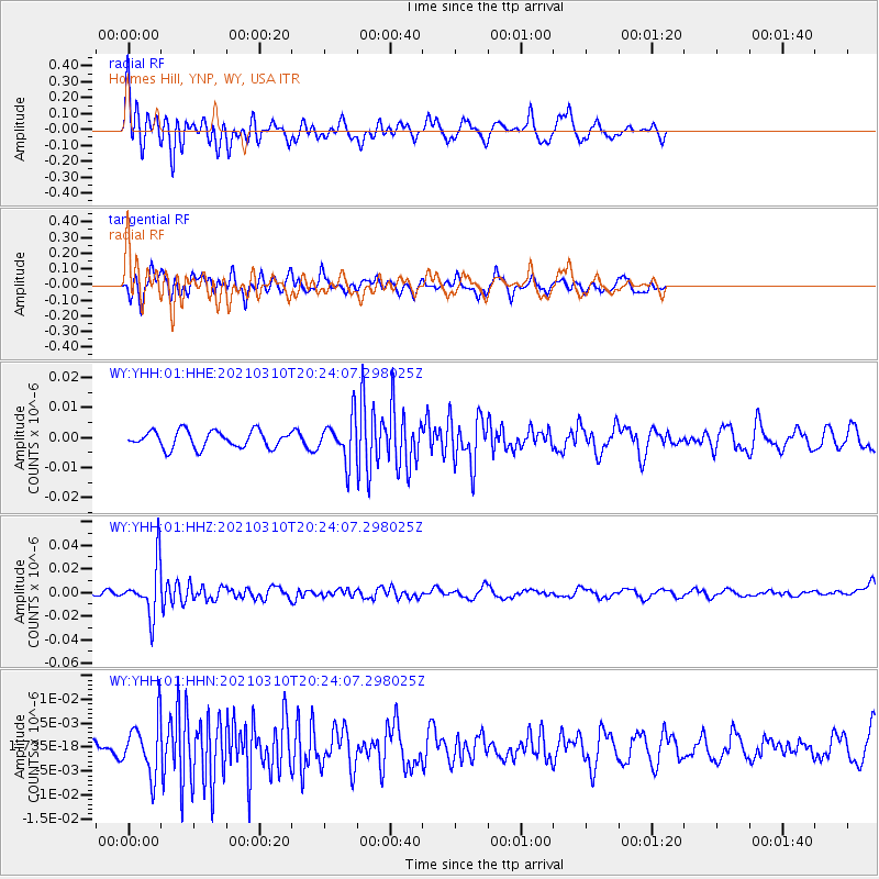
YHH Holmes Hill, YNP, WY, USA - Earthquake Result Viewer
*The percent match for this event was below the threshold and hence no stack was calculated.
| Earthquake location: |
Fiji Islands Region |
| Earthquake latitude/longitude: |
-20.1/-177.7 |
| Earthquake time(UTC): |
2021/03/10 (069) 20:12:37 GMT |
| Earthquake Depth: |
488 km |
| Earthquake Magnitude: |
5.8 Mww |
| Earthquake Catalog/Contributor: |
NEIC PDE/us |
|
| Network: |
WY Yellowstone Wyoming Seismic Network |
| Station: |
YHH Holmes Hill, YNP, WY, USA |
| Lat/Lon: |
44.79 N/110.85 W |
| Elevation: |
2717 m |
|
| Distance: |
88.7 deg |
| Az: |
40.903 deg |
| Baz: |
239.773 deg |
| Ray Param: |
$rayparam |
*The percent match for this event was below the threshold and hence was not used in the summary stack. |
|
| Radial Match: |
61.84814 % |
| Radial Bump: |
349 |
| Transverse Match: |
64.15379 % |
| Transverse Bump: |
400 |
| SOD ConfigId: |
24334971 |
| Insert Time: |
2021-03-24 20:43:19.725 +0000 |
| GWidth: |
2.5 |
| Max Bumps: |
400 |
| Tol: |
0.001 |
|
Signal To Noise
| Channel | StoN | STA | LTA |
| WY:YHH:01:HHZ:20210310T20:24:07.298025Z | 11.418592 | 2.1665505E-8 | 1.8973885E-9 |
| WY:YHH:01:HHN:20210310T20:24:07.298025Z | 2.2011793 | 5.4866294E-9 | 2.4925866E-9 |
| WY:YHH:01:HHE:20210310T20:24:07.298025Z | 2.5001101 | 7.0118773E-9 | 2.8046272E-9 |
| Arrivals |
| Ps | |
| PpPs | |
| PsPs/PpSs | |


