You are here: Home > Network List > UU - University of Utah Regional Network Stations List
> Station HVU Hansel Valley, UT, USA > Earthquake Result Viewer
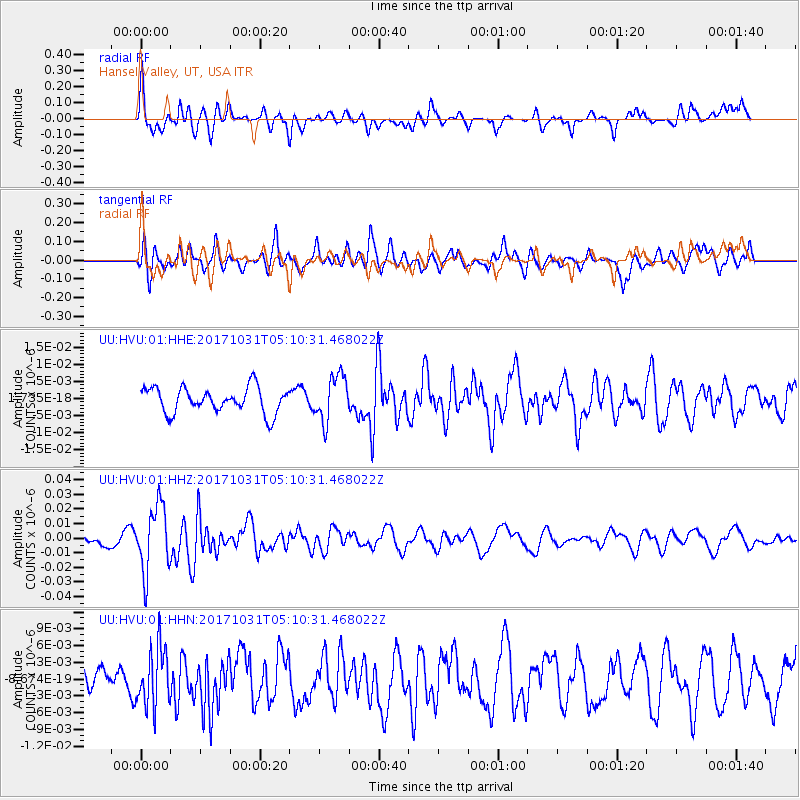
HVU Hansel Valley, UT, USA - Earthquake Result Viewer
*The percent match for this event was below the threshold and hence no stack was calculated.
| Earthquake location: |
Tonga Islands |
| Earthquake latitude/longitude: |
-15.5/-173.3 |
| Earthquake time(UTC): |
2017/10/31 (304) 04:58:58 GMT |
| Earthquake Depth: |
35 km |
| Earthquake Magnitude: |
5.8 mb |
| Earthquake Catalog/Contributor: |
NEIC PDE/us |
|
| Network: |
UU University of Utah Regional Network |
| Station: |
HVU Hansel Valley, UT, USA |
| Lat/Lon: |
41.78 N/112.78 W |
| Elevation: |
1609 m |
|
| Distance: |
79.8 deg |
| Az: |
41.438 deg |
| Baz: |
238.535 deg |
| Ray Param: |
$rayparam |
*The percent match for this event was below the threshold and hence was not used in the summary stack. |
|
| Radial Match: |
72.628975 % |
| Radial Bump: |
400 |
| Transverse Match: |
60.558628 % |
| Transverse Bump: |
400 |
| SOD ConfigId: |
2429771 |
| Insert Time: |
2017-11-14 05:04:10.634 +0000 |
| GWidth: |
2.5 |
| Max Bumps: |
400 |
| Tol: |
0.001 |
|
Signal To Noise
| Channel | StoN | STA | LTA |
| UU:HVU:01:HHZ:20171031T05:10:31.468022Z | 5.772539 | 2.2516307E-8 | 3.9005896E-9 |
| UU:HVU:01:HHN:20171031T05:10:31.468022Z | 1.224172 | 5.270422E-9 | 4.3052952E-9 |
| UU:HVU:01:HHE:20171031T05:10:31.468022Z | 1.8050026 | 6.6441563E-9 | 3.6809675E-9 |
| Arrivals |
| Ps | |
| PpPs | |
| PsPs/PpSs | |


