You are here: Home > Network List > CI - Caltech Regional Seismic Network Stations List
> Station SHO Shoshone, CA, USA > Earthquake Result Viewer
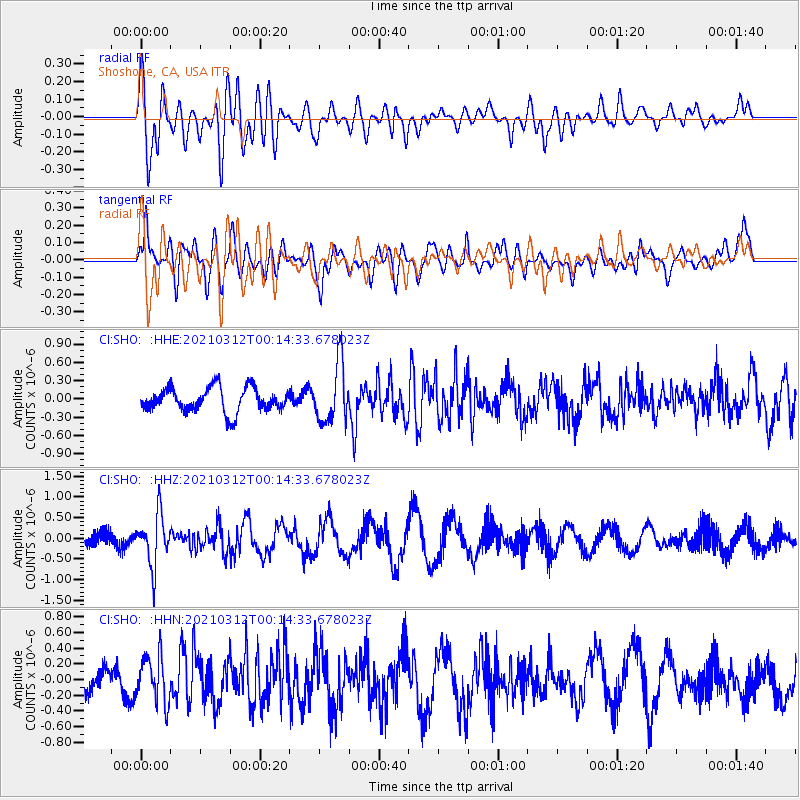
SHO Shoshone, CA, USA - Earthquake Result Viewer
*The percent match for this event was below the threshold and hence no stack was calculated.
| Earthquake location: |
South Of Fiji Islands |
| Earthquake latitude/longitude: |
-25.2/178.4 |
| Earthquake time(UTC): |
2021/03/12 (071) 00:03:19 GMT |
| Earthquake Depth: |
541 km |
| Earthquake Magnitude: |
5.8 mww |
| Earthquake Catalog/Contributor: |
NEIC PDE/us |
|
| Network: |
CI Caltech Regional Seismic Network |
| Station: |
SHO Shoshone, CA, USA |
| Lat/Lon: |
35.90 N/116.28 W |
| Elevation: |
451 m |
|
| Distance: |
86.5 deg |
| Az: |
47.662 deg |
| Baz: |
235.595 deg |
| Ray Param: |
$rayparam |
*The percent match for this event was below the threshold and hence was not used in the summary stack. |
|
| Radial Match: |
68.74305 % |
| Radial Bump: |
400 |
| Transverse Match: |
77.008644 % |
| Transverse Bump: |
400 |
| SOD ConfigId: |
24334971 |
| Insert Time: |
2021-03-26 00:12:15.790 +0000 |
| GWidth: |
2.5 |
| Max Bumps: |
400 |
| Tol: |
0.001 |
|
Signal To Noise
| Channel | StoN | STA | LTA |
| CI:SHO: :HHZ:20210312T00:14:33.678023Z | 3.9648554 | 6.178338E-7 | 1.5582758E-7 |
| CI:SHO: :HHN:20210312T00:14:33.678023Z | 2.758493 | 2.9794933E-7 | 1.08011626E-7 |
| CI:SHO: :HHE:20210312T00:14:33.678023Z | 2.4164097 | 4.777948E-7 | 1.9772921E-7 |
| Arrivals |
| Ps | |
| PpPs | |
| PsPs/PpSs | |


