You are here: Home > Network List > CI - Caltech Regional Seismic Network Stations List
> Station SMM Simmler, CA, USA > Earthquake Result Viewer
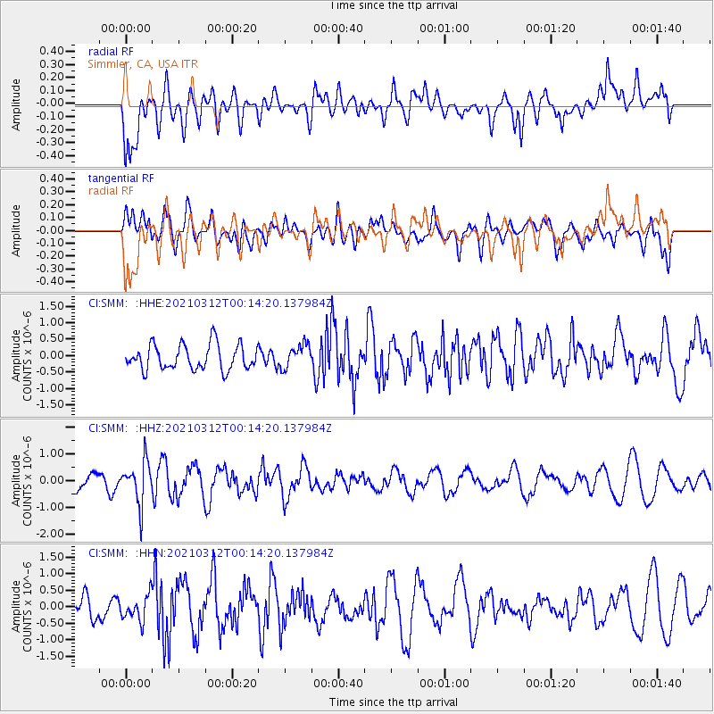
SMM Simmler, CA, USA - Earthquake Result Viewer
*The percent match for this event was below the threshold and hence no stack was calculated.
| Earthquake location: |
South Of Fiji Islands |
| Earthquake latitude/longitude: |
-25.2/178.4 |
| Earthquake time(UTC): |
2021/03/12 (071) 00:03:19 GMT |
| Earthquake Depth: |
541 km |
| Earthquake Magnitude: |
5.8 mww |
| Earthquake Catalog/Contributor: |
NEIC PDE/us |
|
| Network: |
CI Caltech Regional Seismic Network |
| Station: |
SMM Simmler, CA, USA |
| Lat/Lon: |
35.31 N/120.00 W |
| Elevation: |
599 m |
|
| Distance: |
83.7 deg |
| Az: |
46.37 deg |
| Baz: |
233.329 deg |
| Ray Param: |
$rayparam |
*The percent match for this event was below the threshold and hence was not used in the summary stack. |
|
| Radial Match: |
54.450775 % |
| Radial Bump: |
400 |
| Transverse Match: |
41.978645 % |
| Transverse Bump: |
400 |
| SOD ConfigId: |
24334971 |
| Insert Time: |
2021-03-26 00:12:20.331 +0000 |
| GWidth: |
2.5 |
| Max Bumps: |
400 |
| Tol: |
0.001 |
|
Signal To Noise
| Channel | StoN | STA | LTA |
| CI:SMM: :HHZ:20210312T00:14:20.137984Z | 2.6642864 | 8.0238846E-7 | 3.011645E-7 |
| CI:SMM: :HHN:20210312T00:14:20.137984Z | 0.8333771 | 3.866116E-7 | 4.6390954E-7 |
| CI:SMM: :HHE:20210312T00:14:20.137984Z | 0.9500085 | 3.6149152E-7 | 3.80514E-7 |
| Arrivals |
| Ps | |
| PpPs | |
| PsPs/PpSs | |


