You are here: Home > Network List > US - United States National Seismic Network Stations List
> Station ELK Elko, Nevada, USA > Earthquake Result Viewer
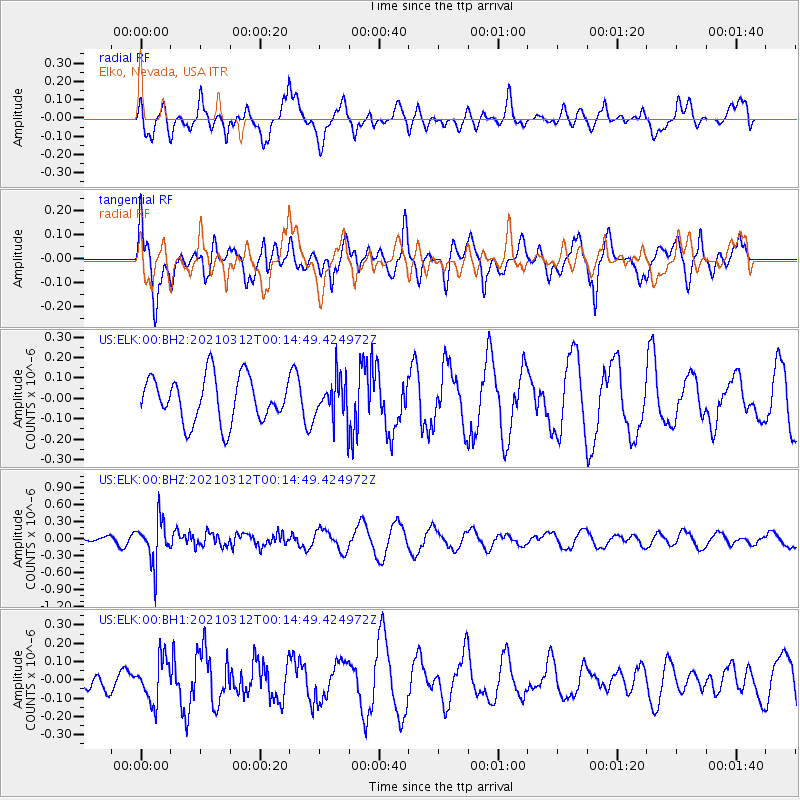
ELK Elko, Nevada, USA - Earthquake Result Viewer
*The percent match for this event was below the threshold and hence no stack was calculated.
| Earthquake location: |
South Of Fiji Islands |
| Earthquake latitude/longitude: |
-25.2/178.4 |
| Earthquake time(UTC): |
2021/03/12 (071) 00:03:19 GMT |
| Earthquake Depth: |
541 km |
| Earthquake Magnitude: |
5.8 mww |
| Earthquake Catalog/Contributor: |
NEIC PDE/us |
|
| Network: |
US United States National Seismic Network |
| Station: |
ELK Elko, Nevada, USA |
| Lat/Lon: |
40.74 N/115.24 W |
| Elevation: |
2210 m |
|
| Distance: |
89.9 deg |
| Az: |
44.114 deg |
| Baz: |
236.127 deg |
| Ray Param: |
$rayparam |
*The percent match for this event was below the threshold and hence was not used in the summary stack. |
|
| Radial Match: |
38.4886 % |
| Radial Bump: |
400 |
| Transverse Match: |
43.93265 % |
| Transverse Bump: |
400 |
| SOD ConfigId: |
24334971 |
| Insert Time: |
2021-03-26 00:19:19.132 +0000 |
| GWidth: |
2.5 |
| Max Bumps: |
400 |
| Tol: |
0.001 |
|
Signal To Noise
| Channel | StoN | STA | LTA |
| US:ELK:00:BHZ:20210312T00:14:49.424972Z | 4.094622 | 3.861988E-7 | 9.431854E-8 |
| US:ELK:00:BH1:20210312T00:14:49.424972Z | 1.0164659 | 1.17712986E-7 | 1.15806124E-7 |
| US:ELK:00:BH2:20210312T00:14:49.424972Z | 0.90855676 | 1.0052256E-7 | 1.10639824E-7 |
| Arrivals |
| Ps | |
| PpPs | |
| PsPs/PpSs | |


