You are here: Home > Network List > UW - Pacific Northwest Regional Seismic Network Stations List
> Station YACT Amboy, WA, USA > Earthquake Result Viewer
YACT Amboy, WA, USA - Earthquake Result Viewer

| Earthquake location: |
South Of Fiji Islands |
| Earthquake latitude/longitude: |
-25.2/178.4 |
| Earthquake time(UTC): |
2021/03/12 (071) 00:03:19 GMT |
| Earthquake Depth: |
541 km |
| Earthquake Magnitude: |
5.8 mww |
| Earthquake Catalog/Contributor: |
NEIC PDE/us |
|
| Network: |
UW Pacific Northwest Regional Seismic Network |
| Station: |
YACT Amboy, WA, USA |
| Lat/Lon: |
45.93 N/122.42 W |
| Elevation: |
211 m |
|
| Distance: |
88.8 deg |
| Az: |
36.838 deg |
| Baz: |
231.127 deg |
| Ray Param: |
0.041673727 |
| Estimated Moho Depth: |
40.5 km |
| Estimated Crust Vp/Vs: |
1.87 |
| Assumed Crust Vp: |
6.566 km/s |
| Estimated Crust Vs: |
3.521 km/s |
| Estimated Crust Poisson's Ratio: |
0.30 |
|
| Radial Match: |
85.98982 % |
| Radial Bump: |
329 |
| Transverse Match: |
85.989876 % |
| Transverse Bump: |
329 |
| SOD ConfigId: |
24334971 |
| Insert Time: |
2021-03-26 00:21:10.262 +0000 |
| GWidth: |
2.5 |
| Max Bumps: |
400 |
| Tol: |
0.001 |
|
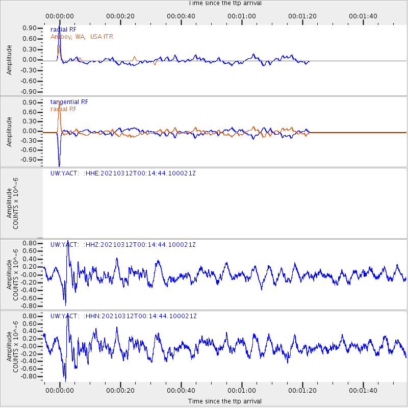
Signal To Noise
| Channel | StoN | STA | LTA |
| UW:YACT: :HHZ:20210312T00:14:44.100021Z | 2.586969 | 3.8108752E-7 | 1.4731043E-7 |
| UW:YACT: :HHN:20210312T00:14:44.100021Z | 2.203784 | 4.3519572E-7 | 1.974766E-7 |
| $trig.getChannelId() | $trig.getValue() | $trig.getSTA() | $trig.getLTA() |
| Arrivals |
| Ps | 5.4 SECOND |
| PpPs | 17 SECOND |
| PsPs/PpSs | 23 SECOND |


