You are here: Home > Network List > G - GEOSCOPE Stations List
> Station INU Inuyama, Japan > Earthquake Result Viewer
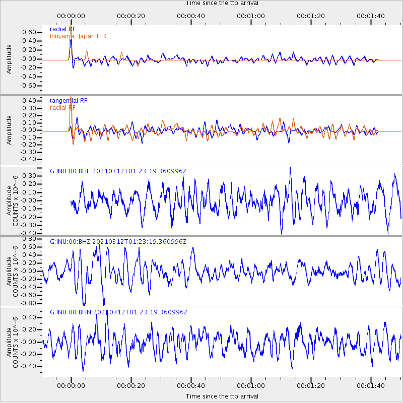
INU Inuyama, Japan - Earthquake Result Viewer
*The percent match for this event was below the threshold and hence no stack was calculated.
| Earthquake location: |
Irian Jaya, Indonesia |
| Earthquake latitude/longitude: |
-4.7/138.4 |
| Earthquake time(UTC): |
2021/03/12 (071) 01:16:16 GMT |
| Earthquake Depth: |
10 km |
| Earthquake Magnitude: |
5.4 Mww |
| Earthquake Catalog/Contributor: |
NEIC PDE/us |
|
| Network: |
G GEOSCOPE |
| Station: |
INU Inuyama, Japan |
| Lat/Lon: |
35.35 N/137.03 E |
| Elevation: |
132 m |
|
| Distance: |
39.9 deg |
| Az: |
358.301 deg |
| Baz: |
177.928 deg |
| Ray Param: |
$rayparam |
*The percent match for this event was below the threshold and hence was not used in the summary stack. |
|
| Radial Match: |
69.29069 % |
| Radial Bump: |
400 |
| Transverse Match: |
53.69981 % |
| Transverse Bump: |
400 |
| SOD ConfigId: |
24334971 |
| Insert Time: |
2021-03-26 01:33:37.766 +0000 |
| GWidth: |
2.5 |
| Max Bumps: |
400 |
| Tol: |
0.001 |
|
Signal To Noise
| Channel | StoN | STA | LTA |
| G:INU:00:BHZ:20210312T01:23:19.360996Z | 3.4470265 | 4.4686098E-7 | 1.2963665E-7 |
| G:INU:00:BHN:20210312T01:23:19.360996Z | 2.3997386 | 2.3443405E-7 | 9.76915E-8 |
| G:INU:00:BHE:20210312T01:23:19.360996Z | 1.4313434 | 1.4152606E-7 | 9.8876384E-8 |
| Arrivals |
| Ps | |
| PpPs | |
| PsPs/PpSs | |


