You are here: Home > Network List > TA - USArray Transportable Network (new EarthScope stations) Stations List
> Station G16K Koyuk River, AK, USA > Earthquake Result Viewer
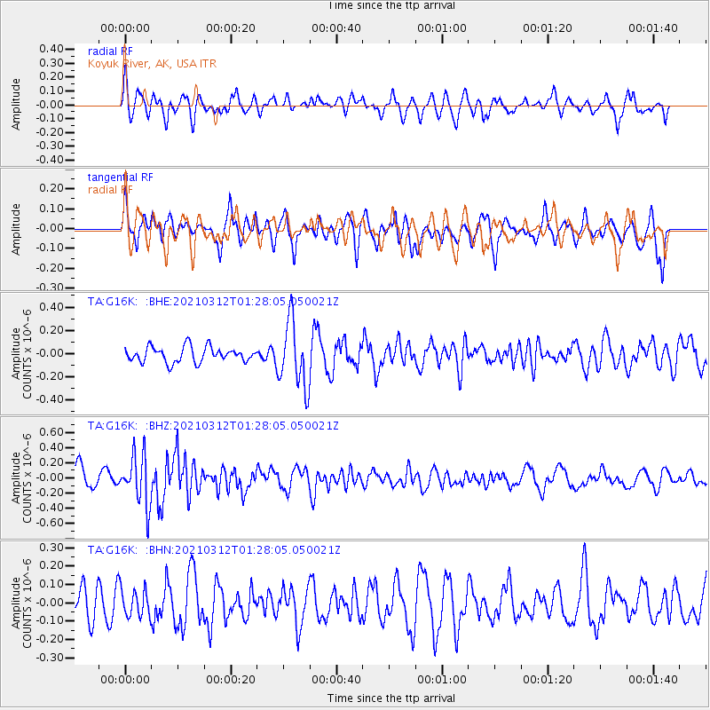
G16K Koyuk River, AK, USA - Earthquake Result Viewer
*The percent match for this event was below the threshold and hence no stack was calculated.
| Earthquake location: |
Irian Jaya, Indonesia |
| Earthquake latitude/longitude: |
-4.7/138.4 |
| Earthquake time(UTC): |
2021/03/12 (071) 01:16:16 GMT |
| Earthquake Depth: |
10 km |
| Earthquake Magnitude: |
5.4 Mww |
| Earthquake Catalog/Contributor: |
NEIC PDE/us |
|
| Network: |
TA USArray Transportable Network (new EarthScope stations) |
| Station: |
G16K Koyuk River, AK, USA |
| Lat/Lon: |
65.39 N/162.35 W |
| Elevation: |
169 m |
|
| Distance: |
82.0 deg |
| Az: |
21.313 deg |
| Baz: |
239.899 deg |
| Ray Param: |
$rayparam |
*The percent match for this event was below the threshold and hence was not used in the summary stack. |
|
| Radial Match: |
53.24266 % |
| Radial Bump: |
400 |
| Transverse Match: |
60.835224 % |
| Transverse Bump: |
400 |
| SOD ConfigId: |
24334971 |
| Insert Time: |
2021-03-26 01:35:58.064 +0000 |
| GWidth: |
2.5 |
| Max Bumps: |
400 |
| Tol: |
0.001 |
|
Signal To Noise
| Channel | StoN | STA | LTA |
| TA:G16K: :BHZ:20210312T01:28:05.050021Z | 2.4759753 | 3.3089586E-7 | 1.3364263E-7 |
| TA:G16K: :BHN:20210312T01:28:05.050021Z | 0.80898947 | 7.152711E-8 | 8.841538E-8 |
| TA:G16K: :BHE:20210312T01:28:05.050021Z | 4.389872 | 2.8741078E-7 | 6.547134E-8 |
| Arrivals |
| Ps | |
| PpPs | |
| PsPs/PpSs | |


