You are here: Home > Network List > TA - USArray Transportable Network (new EarthScope stations) Stations List
> Station G21K Allakaket, AK, USA > Earthquake Result Viewer
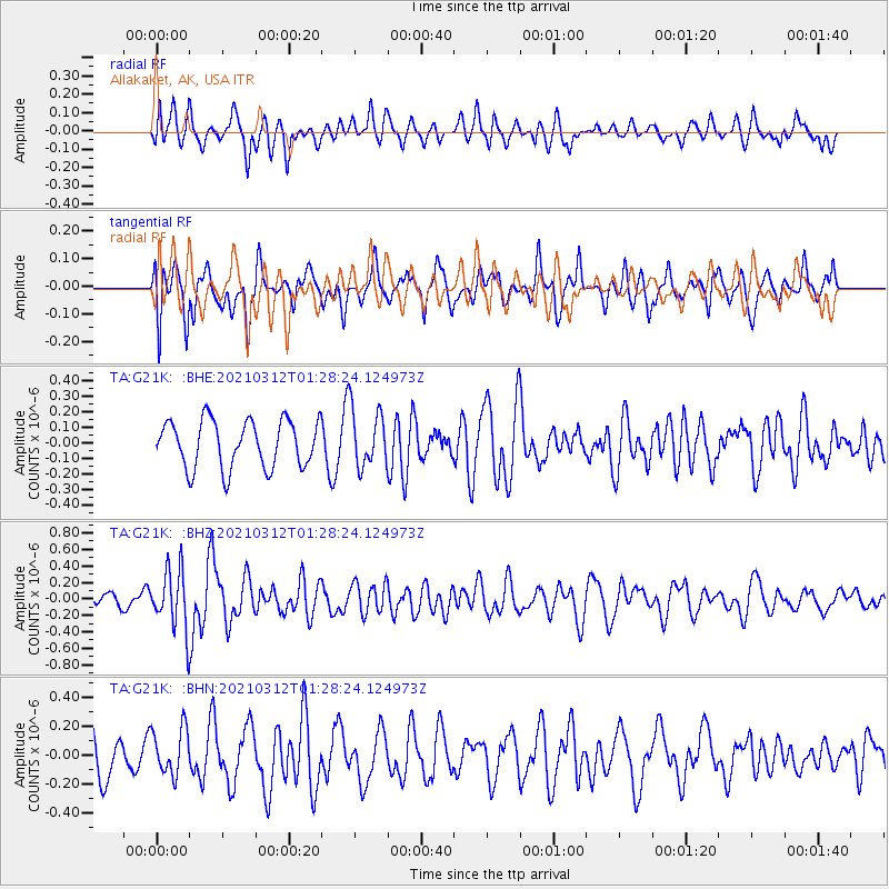
G21K Allakaket, AK, USA - Earthquake Result Viewer
*The percent match for this event was below the threshold and hence no stack was calculated.
| Earthquake location: |
Irian Jaya, Indonesia |
| Earthquake latitude/longitude: |
-4.7/138.4 |
| Earthquake time(UTC): |
2021/03/12 (071) 01:16:16 GMT |
| Earthquake Depth: |
10 km |
| Earthquake Magnitude: |
5.4 Mww |
| Earthquake Catalog/Contributor: |
NEIC PDE/us |
|
| Network: |
TA USArray Transportable Network (new EarthScope stations) |
| Station: |
G21K Allakaket, AK, USA |
| Lat/Lon: |
66.52 N/153.51 W |
| Elevation: |
446 m |
|
| Distance: |
85.8 deg |
| Az: |
21.896 deg |
| Baz: |
248.036 deg |
| Ray Param: |
$rayparam |
*The percent match for this event was below the threshold and hence was not used in the summary stack. |
|
| Radial Match: |
42.05331 % |
| Radial Bump: |
400 |
| Transverse Match: |
53.384567 % |
| Transverse Bump: |
400 |
| SOD ConfigId: |
24334971 |
| Insert Time: |
2021-03-26 01:36:00.747 +0000 |
| GWidth: |
2.5 |
| Max Bumps: |
400 |
| Tol: |
0.001 |
|
Signal To Noise
| Channel | StoN | STA | LTA |
| TA:G21K: :BHZ:20210312T01:28:24.124973Z | 3.5126832 | 3.581071E-7 | 1.0194688E-7 |
| TA:G21K: :BHN:20210312T01:28:24.124973Z | 1.0768409 | 1.6193772E-7 | 1.503822E-7 |
| TA:G21K: :BHE:20210312T01:28:24.124973Z | 1.2493821 | 1.8910933E-7 | 1.5136227E-7 |
| Arrivals |
| Ps | |
| PpPs | |
| PsPs/PpSs | |


