You are here: Home > Network List > TA - USArray Transportable Network (new EarthScope stations) Stations List
> Station I17K Unalakleet, AK, USA > Earthquake Result Viewer
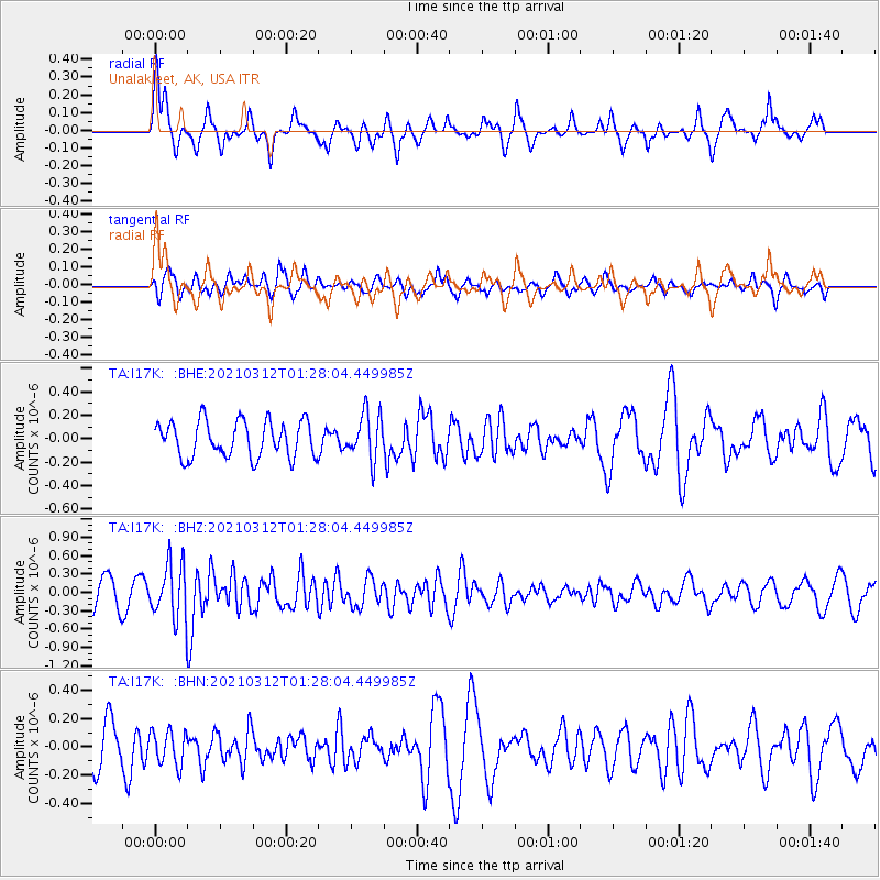
I17K Unalakleet, AK, USA - Earthquake Result Viewer
*The percent match for this event was below the threshold and hence no stack was calculated.
| Earthquake location: |
Irian Jaya, Indonesia |
| Earthquake latitude/longitude: |
-4.7/138.4 |
| Earthquake time(UTC): |
2021/03/12 (071) 01:16:16 GMT |
| Earthquake Depth: |
10 km |
| Earthquake Magnitude: |
5.4 Mww |
| Earthquake Catalog/Contributor: |
NEIC PDE/us |
|
| Network: |
TA USArray Transportable Network (new EarthScope stations) |
| Station: |
I17K Unalakleet, AK, USA |
| Lat/Lon: |
63.89 N/160.70 W |
| Elevation: |
105 m |
|
| Distance: |
81.9 deg |
| Az: |
22.999 deg |
| Baz: |
241.633 deg |
| Ray Param: |
$rayparam |
*The percent match for this event was below the threshold and hence was not used in the summary stack. |
|
| Radial Match: |
47.855362 % |
| Radial Bump: |
263 |
| Transverse Match: |
49.803402 % |
| Transverse Bump: |
329 |
| SOD ConfigId: |
24334971 |
| Insert Time: |
2021-03-26 01:36:09.052 +0000 |
| GWidth: |
2.5 |
| Max Bumps: |
400 |
| Tol: |
0.001 |
|
Signal To Noise
| Channel | StoN | STA | LTA |
| TA:I17K: :BHZ:20210312T01:28:04.449985Z | 2.1547601 | 4.50396E-7 | 2.0902374E-7 |
| TA:I17K: :BHN:20210312T01:28:04.449985Z | 0.9812833 | 1.2093535E-7 | 1.2324203E-7 |
| TA:I17K: :BHE:20210312T01:28:04.449985Z | 1.2787093 | 1.9514098E-7 | 1.5260777E-7 |
| Arrivals |
| Ps | |
| PpPs | |
| PsPs/PpSs | |


