You are here: Home > Network List > PF - Volcanologic Network of Piton de Fournaise-OVPF Stations List
> Station HIM cratere Himiltrude > Earthquake Result Viewer
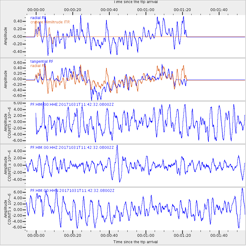
HIM cratere Himiltrude - Earthquake Result Viewer
*The percent match for this event was below the threshold and hence no stack was calculated.
| Earthquake location: |
Seram, Indonesia |
| Earthquake latitude/longitude: |
-3.8/127.7 |
| Earthquake time(UTC): |
2017/10/31 (304) 11:31:42 GMT |
| Earthquake Depth: |
27 km |
| Earthquake Magnitude: |
5.9 Mww |
| Earthquake Catalog/Contributor: |
NEIC PDE/us |
|
| Network: |
PF Volcanologic Network of Piton de Fournaise-OVPF |
| Station: |
HIM cratere Himiltrude |
| Lat/Lon: |
21.21 S/55.72 E |
| Elevation: |
1958 m |
|
| Distance: |
71.9 deg |
| Az: |
249.039 deg |
| Baz: |
87.013 deg |
| Ray Param: |
$rayparam |
*The percent match for this event was below the threshold and hence was not used in the summary stack. |
|
| Radial Match: |
52.935825 % |
| Radial Bump: |
400 |
| Transverse Match: |
49.662464 % |
| Transverse Bump: |
400 |
| SOD ConfigId: |
2429771 |
| Insert Time: |
2017-11-14 11:33:37.556 +0000 |
| GWidth: |
2.5 |
| Max Bumps: |
400 |
| Tol: |
0.001 |
|
Signal To Noise
| Channel | StoN | STA | LTA |
| PF:HIM:00:HHZ:20171031T11:42:32.08002Z | 1.4606204 | 1.8647511E-6 | 1.2766842E-6 |
| PF:HIM:00:HHN:20171031T11:42:32.08002Z | 1.946102 | 3.961849E-6 | 2.035787E-6 |
| PF:HIM:00:HHE:20171031T11:42:32.08002Z | 1.0446362 | 2.6091054E-6 | 2.497621E-6 |
| Arrivals |
| Ps | |
| PpPs | |
| PsPs/PpSs | |


