You are here: Home > Network List > CI - Caltech Regional Seismic Network Stations List
> Station SMM Simmler, CA, USA > Earthquake Result Viewer
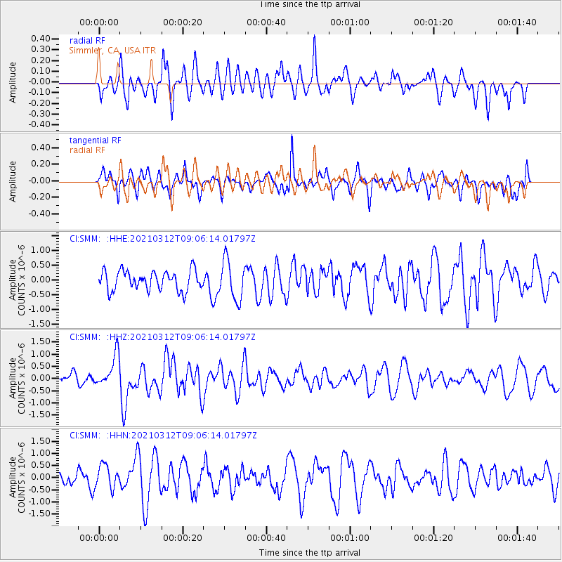
SMM Simmler, CA, USA - Earthquake Result Viewer
*The percent match for this event was below the threshold and hence no stack was calculated.
| Earthquake location: |
Southeast Of Loyalty Islands |
| Earthquake latitude/longitude: |
-22.4/174.4 |
| Earthquake time(UTC): |
2021/03/12 (071) 08:54:12 GMT |
| Earthquake Depth: |
10 km |
| Earthquake Magnitude: |
5.9 Mww |
| Earthquake Catalog/Contributor: |
NEIC PDE/us |
|
| Network: |
CI Caltech Regional Seismic Network |
| Station: |
SMM Simmler, CA, USA |
| Lat/Lon: |
35.31 N/120.00 W |
| Elevation: |
599 m |
|
| Distance: |
84.6 deg |
| Az: |
48.427 deg |
| Baz: |
237.842 deg |
| Ray Param: |
$rayparam |
*The percent match for this event was below the threshold and hence was not used in the summary stack. |
|
| Radial Match: |
52.29031 % |
| Radial Bump: |
400 |
| Transverse Match: |
54.11935 % |
| Transverse Bump: |
397 |
| SOD ConfigId: |
24334971 |
| Insert Time: |
2021-03-26 09:03:14.351 +0000 |
| GWidth: |
2.5 |
| Max Bumps: |
400 |
| Tol: |
0.001 |
|
Signal To Noise
| Channel | StoN | STA | LTA |
| CI:SMM: :HHZ:20210312T09:06:14.01797Z | 2.7386863 | 6.735729E-7 | 2.4594743E-7 |
| CI:SMM: :HHN:20210312T09:06:14.01797Z | 2.0398734 | 4.7369087E-7 | 2.3221581E-7 |
| CI:SMM: :HHE:20210312T09:06:14.01797Z | 2.0977607 | 6.887855E-7 | 3.2834325E-7 |
| Arrivals |
| Ps | |
| PpPs | |
| PsPs/PpSs | |


