You are here: Home > Network List > TA - USArray Transportable Network (new EarthScope stations) Stations List
> Station F26K Sheenjek River, AK, USA > Earthquake Result Viewer
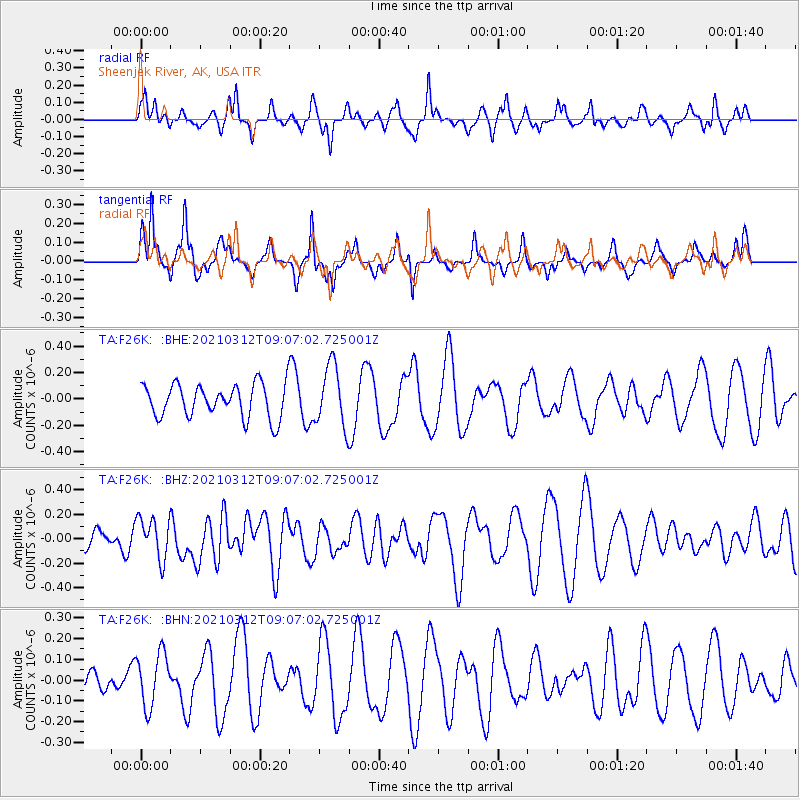
F26K Sheenjek River, AK, USA - Earthquake Result Viewer
*The percent match for this event was below the threshold and hence no stack was calculated.
| Earthquake location: |
Southeast Of Loyalty Islands |
| Earthquake latitude/longitude: |
-22.4/174.4 |
| Earthquake time(UTC): |
2021/03/12 (071) 08:54:12 GMT |
| Earthquake Depth: |
10 km |
| Earthquake Magnitude: |
5.9 Mww |
| Earthquake Catalog/Contributor: |
NEIC PDE/us |
|
| Network: |
TA USArray Transportable Network (new EarthScope stations) |
| Station: |
F26K Sheenjek River, AK, USA |
| Lat/Lon: |
67.69 N/144.15 W |
| Elevation: |
683 m |
|
| Distance: |
94.9 deg |
| Az: |
14.691 deg |
| Baz: |
217.939 deg |
| Ray Param: |
$rayparam |
*The percent match for this event was below the threshold and hence was not used in the summary stack. |
|
| Radial Match: |
55.126286 % |
| Radial Bump: |
327 |
| Transverse Match: |
53.94703 % |
| Transverse Bump: |
292 |
| SOD ConfigId: |
24334971 |
| Insert Time: |
2021-03-26 09:07:49.092 +0000 |
| GWidth: |
2.5 |
| Max Bumps: |
400 |
| Tol: |
0.001 |
|
Signal To Noise
| Channel | StoN | STA | LTA |
| TA:F26K: :BHZ:20210312T09:07:02.725001Z | 1.2408 | 1.6934473E-7 | 1.3648028E-7 |
| TA:F26K: :BHN:20210312T09:07:02.725001Z | 1.925125 | 1.2889517E-7 | 6.695418E-8 |
| TA:F26K: :BHE:20210312T09:07:02.725001Z | 1.8297449 | 2.3092156E-7 | 1.2620424E-7 |
| Arrivals |
| Ps | |
| PpPs | |
| PsPs/PpSs | |


