You are here: Home > Network List > US - United States National Seismic Network Stations List
> Station ELK Elko, Nevada, USA > Earthquake Result Viewer
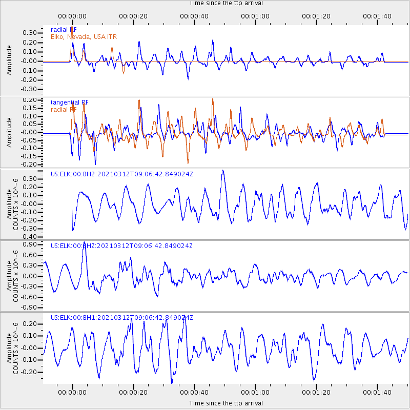
ELK Elko, Nevada, USA - Earthquake Result Viewer
*The percent match for this event was below the threshold and hence no stack was calculated.
| Earthquake location: |
Southeast Of Loyalty Islands |
| Earthquake latitude/longitude: |
-22.4/174.4 |
| Earthquake time(UTC): |
2021/03/12 (071) 08:54:12 GMT |
| Earthquake Depth: |
10 km |
| Earthquake Magnitude: |
5.9 Mww |
| Earthquake Catalog/Contributor: |
NEIC PDE/us |
|
| Network: |
US United States National Seismic Network |
| Station: |
ELK Elko, Nevada, USA |
| Lat/Lon: |
40.74 N/115.24 W |
| Elevation: |
2210 m |
|
| Distance: |
90.6 deg |
| Az: |
45.691 deg |
| Baz: |
240.648 deg |
| Ray Param: |
$rayparam |
*The percent match for this event was below the threshold and hence was not used in the summary stack. |
|
| Radial Match: |
59.627937 % |
| Radial Bump: |
313 |
| Transverse Match: |
54.47838 % |
| Transverse Bump: |
347 |
| SOD ConfigId: |
24334971 |
| Insert Time: |
2021-03-26 09:09:47.513 +0000 |
| GWidth: |
2.5 |
| Max Bumps: |
400 |
| Tol: |
0.001 |
|
Signal To Noise
| Channel | StoN | STA | LTA |
| US:ELK:00:BHZ:20210312T09:06:42.849024Z | 2.1935759 | 4.5456457E-7 | 2.0722538E-7 |
| US:ELK:00:BH1:20210312T09:06:42.849024Z | 1.0402383 | 1.096022E-7 | 1.0536259E-7 |
| US:ELK:00:BH2:20210312T09:06:42.849024Z | 0.71601903 | 9.592523E-8 | 1.3397022E-7 |
| Arrivals |
| Ps | |
| PpPs | |
| PsPs/PpSs | |


