You are here: Home > Network List > AV - Alaska Volcano Observatory Stations List
> Station MAPS Pakushin Southeast, Makushin Volcano, Alaska > Earthquake Result Viewer
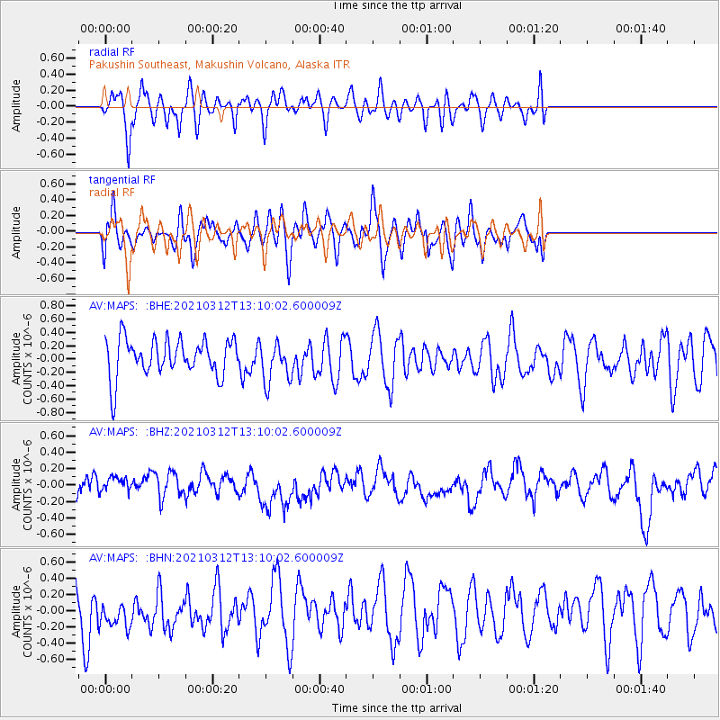
MAPS Pakushin Southeast, Makushin Volcano, Alaska - Earthquake Result Viewer
*The percent match for this event was below the threshold and hence no stack was calculated.
| Earthquake location: |
Greece |
| Earthquake latitude/longitude: |
39.9/22.0 |
| Earthquake time(UTC): |
2021/03/12 (071) 12:57:51 GMT |
| Earthquake Depth: |
10 km |
| Earthquake Magnitude: |
5.6 Mww |
| Earthquake Catalog/Contributor: |
NEIC PDE/us |
|
| Network: |
AV Alaska Volcano Observatory |
| Station: |
MAPS Pakushin Southeast, Makushin Volcano, Alaska |
| Lat/Lon: |
53.81 N/166.94 W |
| Elevation: |
333 m |
|
| Distance: |
86.4 deg |
| Az: |
5.317 deg |
| Baz: |
353.092 deg |
| Ray Param: |
$rayparam |
*The percent match for this event was below the threshold and hence was not used in the summary stack. |
|
| Radial Match: |
53.29832 % |
| Radial Bump: |
400 |
| Transverse Match: |
53.0896 % |
| Transverse Bump: |
400 |
| SOD ConfigId: |
24334971 |
| Insert Time: |
2021-03-26 13:04:09.805 +0000 |
| GWidth: |
2.5 |
| Max Bumps: |
400 |
| Tol: |
0.001 |
|
Signal To Noise
| Channel | StoN | STA | LTA |
| AV:MAPS: :BHZ:20210312T13:10:02.600009Z | 0.6571533 | 9.8001216E-8 | 1.491299E-7 |
| AV:MAPS: :BHN:20210312T13:10:02.600009Z | 0.94001883 | 2.3153552E-7 | 2.4630944E-7 |
| AV:MAPS: :BHE:20210312T13:10:02.600009Z | 1.0868556 | 3.0558672E-7 | 2.8116588E-7 |
| Arrivals |
| Ps | |
| PpPs | |
| PsPs/PpSs | |


