You are here: Home > Network List > IW - Intermountain West Stations List
> Station PLID Pearl Lake, Idaho, USA > Earthquake Result Viewer
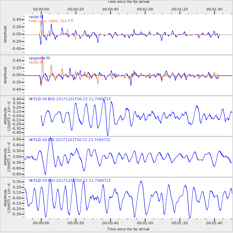
PLID Pearl Lake, Idaho, USA - Earthquake Result Viewer
*The percent match for this event was below the threshold and hence no stack was calculated.
| Earthquake location: |
Loyalty Islands |
| Earthquake latitude/longitude: |
-21.7/168.9 |
| Earthquake time(UTC): |
2017/11/01 (305) 00:09:29 GMT |
| Earthquake Depth: |
10 km |
| Earthquake Magnitude: |
6.1 Mww |
| Earthquake Catalog/Contributor: |
NEIC PDE/us |
|
| Network: |
IW Intermountain West |
| Station: |
PLID Pearl Lake, Idaho, USA |
| Lat/Lon: |
45.09 N/116.00 W |
| Elevation: |
2164 m |
|
| Distance: |
95.2 deg |
| Az: |
43.413 deg |
| Baz: |
244.427 deg |
| Ray Param: |
$rayparam |
*The percent match for this event was below the threshold and hence was not used in the summary stack. |
|
| Radial Match: |
64.31114 % |
| Radial Bump: |
400 |
| Transverse Match: |
69.141335 % |
| Transverse Bump: |
400 |
| SOD ConfigId: |
2429771 |
| Insert Time: |
2017-11-15 00:11:05.360 +0000 |
| GWidth: |
2.5 |
| Max Bumps: |
400 |
| Tol: |
0.001 |
|
Signal To Noise
| Channel | StoN | STA | LTA |
| IW:PLID:00:BHZ:20171101T00:22:21.708972Z | 4.2672286 | 5.006949E-7 | 1.1733492E-7 |
| IW:PLID:00:BH1:20171101T00:22:21.708972Z | 1.9025648 | 2.018672E-7 | 1.0610267E-7 |
| IW:PLID:00:BH2:20171101T00:22:21.708972Z | 1.3765818 | 1.8872834E-7 | 1.3709925E-7 |
| Arrivals |
| Ps | |
| PpPs | |
| PsPs/PpSs | |


