You are here: Home > Network List > US - United States National Seismic Network Stations List
> Station HAWA Hanford, Washington, USA > Earthquake Result Viewer
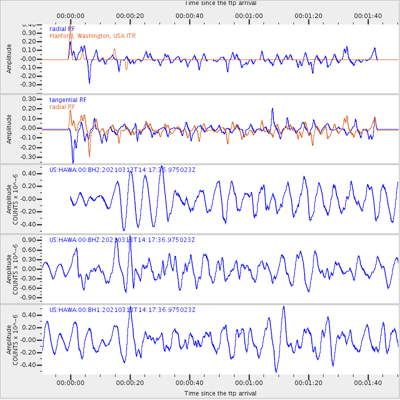
HAWA Hanford, Washington, USA - Earthquake Result Viewer
*The percent match for this event was below the threshold and hence no stack was calculated.
| Earthquake location: |
Kermadec Islands, New Zealand |
| Earthquake latitude/longitude: |
-29.9/-177.9 |
| Earthquake time(UTC): |
2021/03/13 (072) 14:05:01 GMT |
| Earthquake Depth: |
37 km |
| Earthquake Magnitude: |
5.9 mww |
| Earthquake Catalog/Contributor: |
NEIC PDE/us |
|
| Network: |
US United States National Seismic Network |
| Station: |
HAWA Hanford, Washington, USA |
| Lat/Lon: |
46.39 N/119.53 W |
| Elevation: |
364 m |
|
| Distance: |
92.4 deg |
| Az: |
36.123 deg |
| Baz: |
227.725 deg |
| Ray Param: |
$rayparam |
*The percent match for this event was below the threshold and hence was not used in the summary stack. |
|
| Radial Match: |
70.588326 % |
| Radial Bump: |
400 |
| Transverse Match: |
68.5874 % |
| Transverse Bump: |
400 |
| SOD ConfigId: |
24334971 |
| Insert Time: |
2021-03-27 14:21:23.420 +0000 |
| GWidth: |
2.5 |
| Max Bumps: |
400 |
| Tol: |
0.001 |
|
Signal To Noise
| Channel | StoN | STA | LTA |
| US:HAWA:00:BHZ:20210313T14:17:36.975023Z | 1.680675 | 3.922615E-7 | 2.3339521E-7 |
| US:HAWA:00:BH1:20210313T14:17:36.975023Z | 1.1914377 | 1.9075173E-7 | 1.6010215E-7 |
| US:HAWA:00:BH2:20210313T14:17:36.975023Z | 1.4320738 | 2.796776E-7 | 1.9529553E-7 |
| Arrivals |
| Ps | |
| PpPs | |
| PsPs/PpSs | |


