You are here: Home > Network List > US - United States National Seismic Network Stations List
> Station EGMT Eagleton, Montana, USA > Earthquake Result Viewer
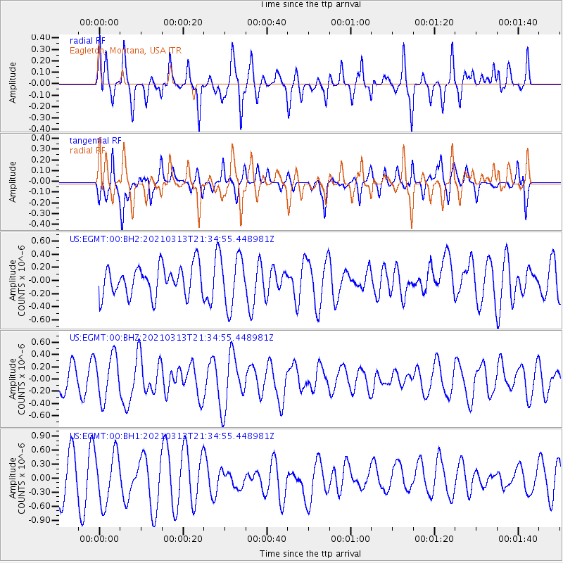
EGMT Eagleton, Montana, USA - Earthquake Result Viewer
*The percent match for this event was below the threshold and hence no stack was calculated.
| Earthquake location: |
Kermadec Islands Region |
| Earthquake latitude/longitude: |
-28.1/-176.5 |
| Earthquake time(UTC): |
2021/03/13 (072) 21:21:57 GMT |
| Earthquake Depth: |
10 km |
| Earthquake Magnitude: |
5.9 Mww |
| Earthquake Catalog/Contributor: |
NEIC PDE/us |
|
| Network: |
US United States National Seismic Network |
| Station: |
EGMT Eagleton, Montana, USA |
| Lat/Lon: |
48.02 N/109.75 W |
| Elevation: |
1055 m |
|
| Distance: |
96.5 deg |
| Az: |
38.385 deg |
| Baz: |
234.766 deg |
| Ray Param: |
$rayparam |
*The percent match for this event was below the threshold and hence was not used in the summary stack. |
|
| Radial Match: |
54.96922 % |
| Radial Bump: |
371 |
| Transverse Match: |
41.159946 % |
| Transverse Bump: |
350 |
| SOD ConfigId: |
24334971 |
| Insert Time: |
2021-03-27 21:37:41.004 +0000 |
| GWidth: |
2.5 |
| Max Bumps: |
400 |
| Tol: |
0.001 |
|
Signal To Noise
| Channel | StoN | STA | LTA |
| US:EGMT:00:BHZ:20210313T21:34:55.448981Z | 2.0831292 | 3.5772834E-7 | 1.7172644E-7 |
| US:EGMT:00:BH1:20210313T21:34:55.448981Z | 1.6076146 | 5.435653E-7 | 3.3811918E-7 |
| US:EGMT:00:BH2:20210313T21:34:55.448981Z | 1.67358 | 3.7529082E-7 | 2.2424433E-7 |
| Arrivals |
| Ps | |
| PpPs | |
| PsPs/PpSs | |


