You are here: Home > Network List > IW - Intermountain West Stations List
> Station PLID Pearl Lake, Idaho, USA > Earthquake Result Viewer
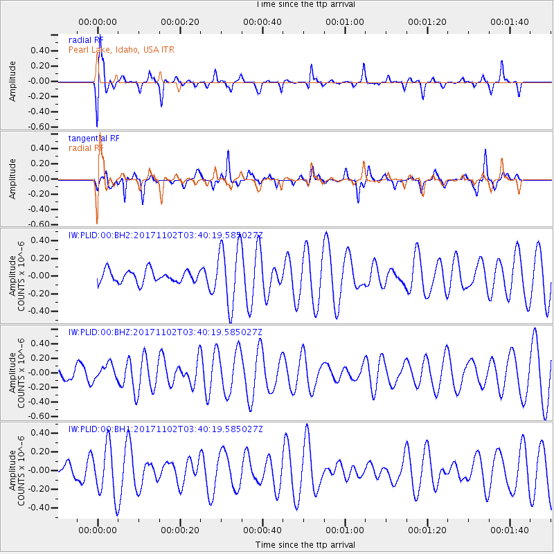
PLID Pearl Lake, Idaho, USA - Earthquake Result Viewer
*The percent match for this event was below the threshold and hence no stack was calculated.
| Earthquake location: |
Loyalty Islands |
| Earthquake latitude/longitude: |
-21.8/168.8 |
| Earthquake time(UTC): |
2017/11/02 (306) 03:27:27 GMT |
| Earthquake Depth: |
10 km |
| Earthquake Magnitude: |
5.6 Mww |
| Earthquake Catalog/Contributor: |
NEIC PDE/us |
|
| Network: |
IW Intermountain West |
| Station: |
PLID Pearl Lake, Idaho, USA |
| Lat/Lon: |
45.09 N/116.00 W |
| Elevation: |
2164 m |
|
| Distance: |
95.3 deg |
| Az: |
43.464 deg |
| Baz: |
244.466 deg |
| Ray Param: |
$rayparam |
*The percent match for this event was below the threshold and hence was not used in the summary stack. |
|
| Radial Match: |
71.18109 % |
| Radial Bump: |
400 |
| Transverse Match: |
72.648636 % |
| Transverse Bump: |
314 |
| SOD ConfigId: |
2429771 |
| Insert Time: |
2017-11-16 03:32:15.882 +0000 |
| GWidth: |
2.5 |
| Max Bumps: |
400 |
| Tol: |
0.001 |
|
Signal To Noise
| Channel | StoN | STA | LTA |
| IW:PLID:00:BHZ:20171102T03:40:19.585027Z | 0.60350895 | 1.0816555E-7 | 1.7922775E-7 |
| IW:PLID:00:BH1:20171102T03:40:19.585027Z | 2.4342382 | 2.7345726E-7 | 1.1233792E-7 |
| IW:PLID:00:BH2:20171102T03:40:19.585027Z | 5.034595 | 3.4981167E-7 | 6.9481594E-8 |
| Arrivals |
| Ps | |
| PpPs | |
| PsPs/PpSs | |


