You are here: Home > Network List > US - United States National Seismic Network Stations List
> Station MSO Missoula, Montana, USA > Earthquake Result Viewer
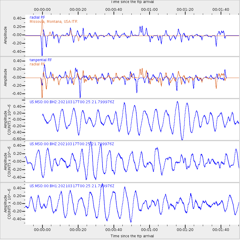
MSO Missoula, Montana, USA - Earthquake Result Viewer
*The percent match for this event was below the threshold and hence no stack was calculated.
| Earthquake location: |
West Chile Rise |
| Earthquake latitude/longitude: |
-40.7/-85.3 |
| Earthquake time(UTC): |
2021/03/17 (076) 00:12:49 GMT |
| Earthquake Depth: |
10 km |
| Earthquake Magnitude: |
5.7 mww |
| Earthquake Catalog/Contributor: |
NEIC PDE/us |
|
| Network: |
US United States National Seismic Network |
| Station: |
MSO Missoula, Montana, USA |
| Lat/Lon: |
46.83 N/113.94 W |
| Elevation: |
1264 m |
|
| Distance: |
90.8 deg |
| Az: |
340.786 deg |
| Baz: |
158.635 deg |
| Ray Param: |
$rayparam |
*The percent match for this event was below the threshold and hence was not used in the summary stack. |
|
| Radial Match: |
52.449203 % |
| Radial Bump: |
400 |
| Transverse Match: |
37.525772 % |
| Transverse Bump: |
308 |
| SOD ConfigId: |
24334971 |
| Insert Time: |
2021-03-31 00:27:14.376 +0000 |
| GWidth: |
2.5 |
| Max Bumps: |
400 |
| Tol: |
0.001 |
|
Signal To Noise
| Channel | StoN | STA | LTA |
| US:MSO:00:BHZ:20210317T00:25:21.799976Z | 1.3514675 | 2.486358E-7 | 1.8397469E-7 |
| US:MSO:00:BH1:20210317T00:25:21.799976Z | 0.75597817 | 1.1001109E-7 | 1.4552151E-7 |
| US:MSO:00:BH2:20210317T00:25:21.799976Z | 0.8194869 | 1.6658846E-7 | 2.0328386E-7 |
| Arrivals |
| Ps | |
| PpPs | |
| PsPs/PpSs | |


