You are here: Home > Network List > TA - USArray Transportable Network (new EarthScope stations) Stations List
> Station G16K Koyuk River, AK, USA > Earthquake Result Viewer
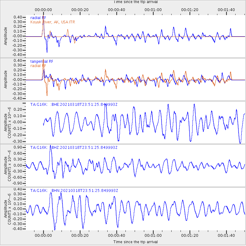
G16K Koyuk River, AK, USA - Earthquake Result Viewer
*The percent match for this event was below the threshold and hence no stack was calculated.
| Earthquake location: |
D'Entrecasteaux Islands Region |
| Earthquake latitude/longitude: |
-9.6/155.6 |
| Earthquake time(UTC): |
2021/03/18 (077) 23:39:41 GMT |
| Earthquake Depth: |
5.0 km |
| Earthquake Magnitude: |
5.5 Mww |
| Earthquake Catalog/Contributor: |
NEIC PDE/us |
|
| Network: |
TA USArray Transportable Network (new EarthScope stations) |
| Station: |
G16K Koyuk River, AK, USA |
| Lat/Lon: |
65.39 N/162.35 W |
| Elevation: |
169 m |
|
| Distance: |
81.0 deg |
| Az: |
16.502 deg |
| Baz: |
221.998 deg |
| Ray Param: |
$rayparam |
*The percent match for this event was below the threshold and hence was not used in the summary stack. |
|
| Radial Match: |
60.134487 % |
| Radial Bump: |
369 |
| Transverse Match: |
56.288136 % |
| Transverse Bump: |
400 |
| SOD ConfigId: |
24334971 |
| Insert Time: |
2021-04-01 23:50:37.097 +0000 |
| GWidth: |
2.5 |
| Max Bumps: |
400 |
| Tol: |
0.001 |
|
Signal To Noise
| Channel | StoN | STA | LTA |
| TA:G16K: :BHZ:20210318T23:51:25.849993Z | 3.0949936 | 4.1738264E-7 | 1.3485736E-7 |
| TA:G16K: :BHN:20210318T23:51:25.849993Z | 1.3388135 | 1.5242057E-7 | 1.1384749E-7 |
| TA:G16K: :BHE:20210318T23:51:25.849993Z | 1.5599234 | 1.5875358E-7 | 1.01770105E-7 |
| Arrivals |
| Ps | |
| PpPs | |
| PsPs/PpSs | |


