You are here: Home > Network List > TA - USArray Transportable Network (new EarthScope stations) Stations List
> Station L15K Ungalak Mountain, AK, USA > Earthquake Result Viewer
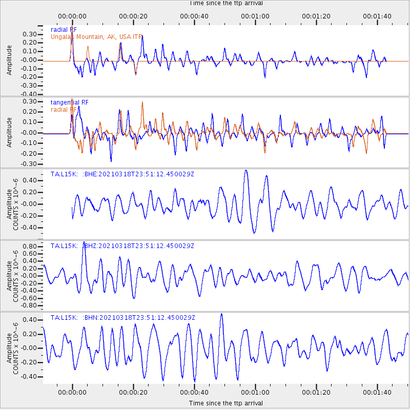
L15K Ungalak Mountain, AK, USA - Earthquake Result Viewer
*The percent match for this event was below the threshold and hence no stack was calculated.
| Earthquake location: |
D'Entrecasteaux Islands Region |
| Earthquake latitude/longitude: |
-9.6/155.6 |
| Earthquake time(UTC): |
2021/03/18 (077) 23:39:41 GMT |
| Earthquake Depth: |
5.0 km |
| Earthquake Magnitude: |
5.5 Mww |
| Earthquake Catalog/Contributor: |
NEIC PDE/us |
|
| Network: |
TA USArray Transportable Network (new EarthScope stations) |
| Station: |
L15K Ungalak Mountain, AK, USA |
| Lat/Lon: |
61.68 N/161.49 W |
| Elevation: |
219 m |
|
| Distance: |
78.5 deg |
| Az: |
19.36 deg |
| Baz: |
223.284 deg |
| Ray Param: |
$rayparam |
*The percent match for this event was below the threshold and hence was not used in the summary stack. |
|
| Radial Match: |
48.617966 % |
| Radial Bump: |
341 |
| Transverse Match: |
62.53236 % |
| Transverse Bump: |
400 |
| SOD ConfigId: |
24334971 |
| Insert Time: |
2021-04-01 23:50:55.156 +0000 |
| GWidth: |
2.5 |
| Max Bumps: |
400 |
| Tol: |
0.001 |
|
Signal To Noise
| Channel | StoN | STA | LTA |
| TA:L15K: :BHZ:20210318T23:51:12.450029Z | 2.3074281 | 3.98954E-7 | 1.7289986E-7 |
| TA:L15K: :BHN:20210318T23:51:12.450029Z | 1.2274225 | 1.8217729E-7 | 1.4842264E-7 |
| TA:L15K: :BHE:20210318T23:51:12.450029Z | 1.0238329 | 1.1985136E-7 | 1.17061454E-7 |
| Arrivals |
| Ps | |
| PpPs | |
| PsPs/PpSs | |


