You are here: Home > Network List > UU - University of Utah Regional Network Stations List
> Station CCUT Cedar City, UT, USA > Earthquake Result Viewer
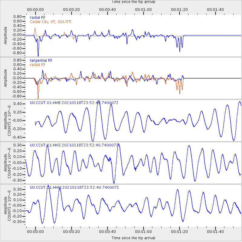
CCUT Cedar City, UT, USA - Earthquake Result Viewer
*The percent match for this event was below the threshold and hence no stack was calculated.
| Earthquake location: |
D'Entrecasteaux Islands Region |
| Earthquake latitude/longitude: |
-9.6/155.6 |
| Earthquake time(UTC): |
2021/03/18 (077) 23:39:41 GMT |
| Earthquake Depth: |
5.0 km |
| Earthquake Magnitude: |
5.5 Mww |
| Earthquake Catalog/Contributor: |
NEIC PDE/us |
|
| Network: |
UU University of Utah Regional Network |
| Station: |
CCUT Cedar City, UT, USA |
| Lat/Lon: |
37.55 N/113.36 W |
| Elevation: |
2127 m |
|
| Distance: |
96.6 deg |
| Az: |
53.122 deg |
| Baz: |
263.064 deg |
| Ray Param: |
$rayparam |
*The percent match for this event was below the threshold and hence was not used in the summary stack. |
|
| Radial Match: |
84.554054 % |
| Radial Bump: |
356 |
| Transverse Match: |
65.85478 % |
| Transverse Bump: |
400 |
| SOD ConfigId: |
24334971 |
| Insert Time: |
2021-04-01 23:51:55.808 +0000 |
| GWidth: |
2.5 |
| Max Bumps: |
400 |
| Tol: |
0.001 |
|
Signal To Noise
| Channel | StoN | STA | LTA |
| UU:CCUT:01:HHZ:20210318T23:52:40.740007Z | 1.4115121 | 1.7236589E-7 | 1.2211434E-7 |
| UU:CCUT:01:HHN:20210318T23:52:40.740007Z | 1.3302517 | 1.7186824E-7 | 1.2919979E-7 |
| UU:CCUT:01:HHE:20210318T23:52:40.740007Z | 2.3870633 | 3.1341693E-7 | 1.3129814E-7 |
| Arrivals |
| Ps | |
| PpPs | |
| PsPs/PpSs | |


